The Society Islands, or French Polynesia, January 1896–April 1896
Reid L. Neilson and Riley M. Moffat, eds., Tales from the World Tour: The 1895–1897 Travel Writings of Mormon Historian Andrew Jenson (Provo, UT: Religious Studies Center; Salt Lake City: Deseret Book, 2012), 223–65.
The Society Islands Mission embraces three groups of islands, namely the Society Islands (consisting of the so-called Windward and Leeward islands), the Tuamotu Archipelago, and the scattered Austral Islands, of which Tubuai is the principal member. The Lower Tuamotu conference embraces all the islands of the Tuamotu group lying west of longitude 42˚45´ west of Greenwich, and the Upper Tuamotu conference all the Tuamotu Islands lying east of the meridian named. The Austral Conference takes in all the Austral Islands, though nearly all the Saints reside on the island of Tubuai. As there is only a very few scattered Saints on the Society Islands, and those few all on Tahiti, these islands are not included in any conference organization; but as they are otherwise interesting, and may perhaps become a future missionary field, I will give a few particulars concerning them.
—Andrew Jenson [1]
 French Polynesia, Vivien de Saint-Martin, Atlas universel de géographie (Paris: Librairie Hachette, 1923)
“Jenson’s Travels,” February 14, 1896 [2]
Papeete, Tahiti, Society Islands
Thursday, January 23. After giving the parting hand to Elders William Gardner, John Johnson, and R. Leo Bird, I boarded the little steamer Richmond and sailed from Auckland, New Zealand, at 6:10 p.m., bound for Tahiti, Society Islands. The weather was good, and the long voyage commenced under the most favorable circumstances. The course taken was a northeasterly one across the Hauraki Gulf, and we passed into the ocean proper with Cape Colville on our right and the Great Barrier on our left. Just as we were eating supper in the cabin an alarm was sounded on deck, and thinking that a man had fallen overboard or that something serious had happened, we all rushed on deck, when it was discovered that one of the sailors had got his hand entangled in the chain connected with the ship’s rudder. The limb was badly squeezed and wounded, causing the blood to flow freely, but no bones were broken. I had a good night’s rest but felt somewhat lonesome.
Friday, January 24. I spent my first day at sea reading, the weather being fine and the sea smooth. No seasickness was experienced by anyone onboard. At noon our position was 17º17΄ S latitude and 177º41΄ E longitude; the distance from Auckland was 187 and to Rarotonga 1,463 geographical miles. I also became acquainted with the other passengers, of which there were only four, namely, three French pearl merchants and Mr. Edenborough, who is part owner of the steamer. The ship’s crew consists of the captain (Robert G. Sutton, a congenial Scotchman), two officers, nine sailors, three engineers, six firemen, two cooks, and two stewards, making twenty-five men altogether. Adding the five passengers, we are thirty souls onboard, and not a woman among us. The ship is loaded with merchandise for different islands of the Cook and Society groups. There are also five bullocks, twenty sheep, two cats, and two canary birds onboard. The rats, of which there are many, were not counted. The ship registers 750 tons, was built in Dundee, Scotland, about ten years ago, and has the reputation of being an excellent sea boat.
Saturday, January 25. The weather continued fine and the sailing pleasant.
Sunday, January 26. Ditto.
Monday, January 27. Ditto.
Tuesday, January 28. Ditto.
Wednesday, January 29. Ditto, but the weather is getting warmer. I have spent the time onboard so far reading, writing, and conversing with passengers, ship’s officers, and the ordinary sailors, cooks, and all on Utah, the Mormons, true versus false religion, the condition of the world, the prospects of war, and scores of other subjects; but as it was not customary to have preaching or lectures given onboard the Richmond, I did not apply for the privilege of speaking publicly. The voyage has been somewhat monotonous; not a sail or vessel seen of any kind since we left Auckland. One of the most enjoyable features of the trip has been the watching of the beautiful sunsets nearly every evening.
Thursday, January 30. Last night we crossed the line known as the Tropic of Capricorn, and thus the beautiful morning found us watching the limits of the tropics. At noon we were in latitude 22º26´ S; longitude 160º63´ W. We crossed the 180th meridian several days ago, but the ship still keeps New Zealand time. We are now 1,554 miles from Auckland, and it is 96 miles to Rarotonga; the thermometer stands at 82º F in the shade. In the afternoon some of the sailors announced that they saw land ahead, and at 6:00 p.m. the mountainous heights of Rarotonga could be seen with the naked eye by the ordinary mortal. The evening was most beautiful and almost cloudless, and the bright full moon beamed upon us and upon the broad expanse of the ocean in such perfect grandeur that words fail to express the thoughts that passed through my mind in thus gazing upon the beauties of nature. The island came nearer and nearer, and its rugged mountain peaks, which in some instances attain a height of nearly 3,000 feet, seemed to possess a peculiar charm and attraction on this occasion; for hours I never tired resting my eyes upon them. Soon we saw a bright light on the west shore of the island; next we could see and hear the breakers spend their fury upon the coral reef which encircles Rarotonga; and, finally, after rounding a point, we cast anchor off the town of Avarua, about half a mile from the shore, on the north side of the island at 10:00 p.m. There is a little harbor at this place protected from the ocean by a coral reef, through which there is an opening about one hundred yards wide; but the water in the harbor is only deep enough for very small vessels; the Richmond draws too much water to go in, hence our anchorage on the outside. Soon after anchoring, a boat manned by about a dozen natives came out, when it was decided to unload the cargo which we had onboard for this island at once. A whistle, which was understood onshore, was blown, after which a number of boats were soon plying between the ship and the wharf, bringing in the goods; and this work went on most of the night. I landed in one of the first boats, and spent about three hours onshore, where I found nearly the entire population of the town, both whites and natives, gathered around the post office, anxious to receive the mail which the Richmond had just brought. And this was not to be wondered at, for it was nearly two months since the previous mail had reached the island, as the steamer did not make her usual trip in December last. I conversed with a number of people, among whom Mr. Fred J. Moss, the British resident; John J. K. Hutchin, the chief Protestant missionary in the Cook Islands; Henry Nicholas, a New Zealand Maori who is the editor and proprietor of a little newspaper called Te Torea; Mr. Hubert Case, a Josephite missionary; and others. By means of these conversations I obtained considerable information about the Cook Islands, which I believe are very little known to the average American newspaper reader. It was about 2:00 a.m. in the night when I returned to the ship.
The Cook Islands are eight in number and lie in the Pacific Ocean between 18º and 22º S longitude and 158º and 161º W longitude. The most important, the most fertile, and perhaps the most beautiful island of the group is Rarotonga, which is situated in 21º S latitude and between 160º W longitude [sic]. The island is of volcanic formation with mountains rising to a height of nearly three thousand feet, clothed in forest and bush of different tropical varieties. The circuit of the island is about twenty-five miles, and a good carriage road has been made all around it. A few small openings break the coral reef surrounding the island, an advantage which has made Rarotonga the chief resort of shipping and the center of trade for the group. The natives are good ship and boat builders. One of their vessels, a schooner of about 100 tons, recently built entirely by the natives, has already made several visits to Auckland. All their vessels are worked by native sailors; but when they make distant voyages, a European master is engaged. A census of the inhabitants of Rarotonga was taken June 30, 1895, which was the first regular census attempted in any one of the Cook Islands. According to the returns of that census, the inhabitants of Rarotonga numbered 2,454 souls, namely, 1,350 males and 1,104 females. Of this number, 2,121 were natives of the Cook Islands; 186 were born in other Pacific islands, 59 in great Britain, 24 in America, 4 in Germany, 1 in France, 2 in Norway, 8 in Portugal, 11 in China, and 38 (mostly half-castes) in other countries. In the matter of fruit growing, especially oranges and bananas, Rarotonga can hardly be surpassed. The native houses of the island are generally roomy and well built, and are mostly clustered together in villages which are all situated on the seacoast, on the strip of level lands which intervened between the foot of the mountains and the sea shore. The weekly newspaper (Te Torea) is published at Rarotonga by Henry Nicholas, a small four-page folio printed in both English and native in parallel columns; it is highly appreciated by the natives, who take special delight in waiting for it, the editor’s greatest trouble being to find space for their effusions. The other islands belonging to the group are Mangaia, lying 110 miles southeast of Rarotonga; Aitutaki, about 150 miles north of Rarotonga, Atiu, Mitiaro, and Mauke, lying about twenty miles apart and from 100 to 120 miles northeast of Rarotonga; and the two small Hervey Islands (called by the natives Manuae and Vitake) lying between Aitutaki and Atiu.
The Cook Islands are now a federation, which has a regular government, and derives a regular revenue from import duty. The population is about 8,000. The imports for 1894 amounted to £22,433, and the exports to £20,665. Of the imports, £13,151 were from, and of the exports £15,909 to, New Zealand. The chief exports are coffee, of which a very fine quality is grown, copra (the dried coconut), oranges, and general tropical fruits and cotton. Coffee and oranges grow very luxuriantly and without much care. Cotton, owing to low prices, has gone largely out of cultivation, though £1,700 sterling worth was shipped in 1894. Owing to their thorough natural drainage, the islands have a wonderfully good and dry climate—cool and agreeable for a tropical climate. Hurricanes are rare. The wet season lasts only from December to the end of March and has little of the close humid weather that prevails in many South Pacific Islands. The natives belong to the Polynesian race and speak nearly the same language as the Maoris of New Zealand and possess all the qualities, good and bad, of that most amiable of dark-skinned races. The rule of the chiefs among the natives has always been absolute. Each tribe has its ariki (king or queen as the case may be), who is really the leading maturapo, or noble. The ariki is only the first among equals, the mataiapos being the real rulers. Those holding land directly of a mataiapo are called rangatiras. There are no money rents, but an ariki receives certain definite services from the mataiapos, and, through the mataiapos, from the rangatiras. These services are all honorable; but below the rangatiras are the ungas, whose work is of a menial nature, such as pig feeding, cooking, etc. There is no armed body of any kind on the islands, and crime is claimed to be almost unknown, at least on Rarotonga. A very small body of police, or rather watchmen, suffices to keep order, despite the perpetual petty quarrels in which the remnants of old jealousies still involve the natives.
Some of the islands belonging to the group were introduced to the civilized world by the great navigator Captain James Cook, who in 1777 during his third great voyage of explorations around the world [sic]. The islands visited by him that year were Atiu and Mangaia, and the two little islets which he (on first discovering them in 1773) called the Hervey Islands, after one of the lords of the Admiralty of his day. The name “Hervey” has in consequence, often been applied to the whole group, but wrongly. The Cook Islands is the only name by which the group is officially known. Captain Cook never visited Rarotonga, where he might easily have landed and obtained supplies; but he didn’t discover that island. Those at which he touched faced him with unbroken coral reefs and surfs through which no boats could pass, while the natives were drawn up along the shore in menacing array. At that time the natives were cannibals, and in constant warfare with each other. Generally three distinct tribes lived on each of the larger islands, and each tribe was at war with its neighbors.
In 1821, Mr. John Williams, a London Society missionary, came from Raiatea, one of the Society Islands, to Aitutaki and established a mission there. From that island missionary labors were extended to the other members of the group, and by 1825 nearly all had embraced Christianity as taught by the London Society missionaries, and men, women, and children flocked to the schools to learn reading and writing. Soon, also they began to adopt European habits, some of which were good and others bad. Among other things they made for themselves a tasteful style of European dress from European cloth. But while they had flourished and multiplied in numbers under heathenism and in the midst of war, they soon commenced to decrease alarmingly fast under the new conditions of living. Various causes have been assigned for this. When the missionaries first came, the population was estimated at 16,000. Thus, during the seventy years which have elapsed since that time, they have dwindled down to one-half of that number.
Fearful that the islands might be taken possession of by the French or Germans, the natives sought the protection of Great Britain. In 1885, Makea Takau, the ariki va‘ine, or queen, of Avarua, one of the three districts of Rarotonga, visited Auckland, New Zealand, and there saw Mr. Ballance, the minister of native affairs, who, agreeable to the queen’s request, represented the situation in the Cook Islands to the Imperial government. Always on hand to extend her possessions and influence, Great Britain readily responded to the request of the native queen for imperial protection, and on October 27, 1888, the British flag was hoisted on the islands, which were thus placed under British protectorate. The natives were assured that neither their laws and customs then in force nor the governments of their arikis (chiefs) would in any way be interfered with. This agreement has ever since been complied with. In December 1890, a British resident was appointed in the person of Mr. Frederick J. Moss, who, since April 1891, when he finally entered upon the duties of his office, has done a great work in behalf of the people. His office is to advise the natives, to see that no injustice is done to anyone on the islands, and to protect British interest in particular. At the instance of Mr. Moss, delegates were sent from the various islands to Rarotonga to frame a constitution for a contemplated federation and government of the group. The delegates met June 4, 1891, and remained in session till the 10th, when a simple constitution was adopted, leaving each island free to regulate its own affairs but creating a federal parliament to raise a custom revenue and see to mail services and other purely federal matters. The appointment of a chief was one of the greatest difficulties in the way of federation, but finally, after much disputation, the queen Makea Takau was elected to hold the office for life.
Under the constitution adopted, Rarotonga, Mangaia, and Aitutaki send each three members to the Federal Parliament; and Atiu, Mitiaro, and Mauke, who for a long time had been under one local administration, sent three more, making twelve in all. The members meet at Rarotonga in a parliament house which was built for that purpose in 1893. The islands have in great measure laid aside their mutual jealousies, and the business of the government is now carried on without much difficulty. Public schools for teaching English and the general branches of education are also being established, and the steamer Richmond on her present trip brought the first furniture for such a school which is about to be opened at Rarotonga. At present the only taxation is a federal import duty of five percent ad valorem. The sale of stamps by the post office is also a source of revenue. British coin has been the only legal currency since January 1, 1895; but the Chilean dollar is still used by everybody except the government. Originally introduced as equivalent to four shillings, this dollar has fallen in value until it is now passed for two shillings. This is caused by the fall of the price of silver of late years; the bullion value of the Chilean dollar at the present time is only one and a half shilling. It is about twice the size and weight of the English florin, its equivalent as coin and is preferred by the natives on that account. In the Cook Islands there is no definite wages class. All the Rarotonga people have land enough to supply themselves and households with food; but the land is held by the household or family and not by the individual cultivator. They have no rent to pay and work only to obtain such luxuries or enjoyments as they may desire. Those who have to pay rent are natives coming from other islands. They are also the chief workers for wages; but their number is not large. Under these conditions there is no accumulation of wealth, and consequently no reserve of capital. [3]
Friday, January 31. The Richmond resumed her voyage at 4:30 a.m., and when I got up on deck, at 7:30 a.m., the island of Rarotonga was only visible as a little speck against the western horizon. A number of passengers came onboard at Rarotonga, among who were the Josephite missionary Hubert Case and wife, who are returning from an unsuccessful missionary trip to Rarotonga. They brought with a little six-week-old child who was born on Rarotonga. After sailing in a southeasterly direction till noon, land was again seen ahead, which proved to be the island of Mangaia, one of the Cook Islands situated about 110 miles southeast of Rarotonga. About 4:00 p.m. we came to a “standstill” about a quarter of a mile off the west coast of Mangaia, where the main village (Oneroa) of the island is beautifully situated in a coconut grove. Soon we saw a canoe with two white traders and three natives in it push through the breakers and make for the ship. The two traders came onboard and remained with us nearly an hour while the natives took the mail matter to shore and then returned in company with a bigger canoe on which two heavy bales of paper was sent onshore for the London Society missionary who resides on Mangaia and who has a printing press on which he prints occasional pamphlets in the native language. It seemed to require the utmost skill on the part of the natives to steer the canoe through the breakers, who spent their fury on the coral reef which bounds the coast at this point. There is absolutely no consistent landing place on this island; and in stormy weather it is impossible to effect a landing on this or any other part of Mangaia. This makes trade with the island very difficult.
Mangaia is about twenty-eight miles in circumference, is of coral formation, and is covered with tropical vegetation; its highest point is less than 700 feet above sea level. There are about 2,000 natives, most of whom live in three main villages, namely, Oneroa, on the west; Tamarua, on the south; and Avarua, on the east coast. The white population consists of seven persons, namely, three traders, one London Society missionary, and three women. Of the latter, two are the wife and servant girl of the missionary, and the other, wife to one of the traders. The missionary church edifice, a concrete building with thatched roof, is situated on rising ground near the shore and looks quite imposing from the sea; it is said to be one of the finest and largest houses of worship on the South Sea Islands. The London Missionary Society representative on this island apparently has it all his own way. No other religious denomination is represented here, not even the Catholics; hence the inhabitants are governed under church discipline, and so rigged and tyrannical were some of the church laws and rules being enforced a few years ago that complains were finally made to the British resident in Rarotonga, who in October 1893 visited the island in person and effected a change of local government affairs. He found on his arrival that 194 native missionary policemen were employed to preserve order among a population of a little more than 2,000 souls; and that in trying to correct errors in the morals of the people the female offenders were punished much more severely than their male paramours, and that, too, in a manner that would naturally cause the heart of every British and American citizen to burn with indignation. Mr. Moss, the British resident, caused a law to be passed cutting the number of policemen down to twelve and thus compelled 182 able-bodied men to seek other employment. Complaints were also made against the London Society missionary, who was the instigator of the almost inhuman and barbarous punishment inflicted upon the women of the island who were suspected or proven guilty of loose habits; and in due course of time the missionary was called away, and a different man appointed to be his successor. The inhabitants of Mangaia seem to be of a warlike and quarrelsome disposition; each of the three villages of native districts have their own local self-government and do not recognize a common head; nor do they seem to attach much importance to the federation inaugurated under the auspices of the British resident, though they generally send their respective members to the Rarotongan parliament. The traders, who came onboard the Richmond, gave the natives a very hard name morally and also said that they lacked the hospitality and kindheartedness which generally characterize the inhabitants of the South Sea Islands and that they are very selfish and avaricious indeed. The products exported from Mangaia are mostly copra and oranges. Steamers only call two or three times a year, and that during the orange season mostly, while small sailing vessels constantly ply between that and the neighboring islands.
Early in 1845, Elder Noah Rogers visited Mangaia as a Latter-day Saint missionary. He came from the Society Islands and found the language of the Mangaians somewhat different to that spoken on Tahiti; however, he could understand them, and as there was no white missionary on the island at the time Elder Rogers offered to tarry and teach them. But he was informed that two London Society Missionaries in Tahiti (Messrs. Platt and Baff) had written to the natives on Mangaia, warning them against receiving any missionaries or teachers unless they brought letters of recommendation from them. Consequently, they had passed a law to the effect that no white man should live among them. Thus Elder Rogers was compelled to leave without having a hearing, and he proceeded eastward to Rurutu, where he was told a similar story, and found that the missionaries named had written to other islands to the same effect in order to prevent Brother Rogers or any other Latter-day Saint elder from commencing missionary operations in that part of the Pacific. So far as I know no subsequent efforts have been made by any of our elders to preach the gospel to the natives of the Cook Islands nor Rurutu, which latter island lies about 350 miles southwest of Tahiti.
We resumed our voyage from Mangaia at 5:00 p.m. and spent another pleasant night on the briny deep.
Saturday, February 1. The day was cloudy, and it rained a little. When the usual nautical observations were made at noon by the ship’s officers, we were in latitude 20º S and longitude 155º38´ W. Our course was north 50º E. We were 176 miles from Mangaia and 318 from Raiatea. I spent most of the day conversing with the ships’ officers and passengers. [4]
Sunday, February 2. I spent part of the day reading. At noon we were only eighty-seven miles from Raiatea, and early in the afternoon the mountainous outlines of that historical island were seen straight ahead. A little later the islands of Tahaa and Bora Bora, all members of the Society group, were visible a little to the left of Raiatea. At 3:30 p.m. the machinery was stopped in order to make some slight repairs, and we “laid by” for about an hour. When we resumed the voyage, we only proceeded forward slowly, as we would not be able to land at Raiatea till the next morning, owing to the dangerous reef through which we would have to pass by daylight. The night was dark until the moon arose, when the voyage around the south end of Raiatea became very interesting. I stood on the bridge conversing with the captain till a late hour. The ship, after reaching the east side of the island, “stood off and on” till morning.
Monday, February 3. Just after the dawn of day, the Richmond was enabled to run through the narrow passage of the coral reef and soon reached the stone wharf at Uturoa, the main village of Raiatea, which is situated on the northeast coast of the island looking over toward Tahaa, the neighboring island. Both islands are enclosed by the same coral reef, and the four-mile-wide channel between them is not passable for ships, except by very careful manipulations following the various windings or narrow passages through the coral reef. Both islands are of volcanic formation and present a general tropical appearance. Raiatea has about 2,000 and Tahaa 1,000 inhabitants, nearly all natives. On landing at Uturoa, Raiatea, we found the people in their holiday attire, it being Sunday with them, which indeed is the correct time, as this island lies in 151º32´ W longitude from Greenwich. I took a long walk along the road following the beach and conversed with quite a number of natives who could talk a little English. The south end of the island is in a state of rebellion against the French government, and as a matter of protection to themselves the people have hoisted the British colors. It mattered not that a French man-of-war came along a short time ago and shot and pulled down a number of these flags, for as soon as the soldiers had gone away they hoisted them again. The queen of the island has accepted of French protection and keeps the protectorate flag waving from her domicile, which is located somewhat centrally on the east coast. The north end, or the part of the island where we landed, has declared itself French altogether. Thus there are three parties on this little island, of which one hoists the French, the other the French protectorate, and the third the British flag. The natives generally favor the British government, which seems to have done them a flagrant injustice by selling them for a “mess of pottage.” It seems that in the controversy between England and France in regard to their respective New Zealand possessions, England finally agreed to give up her claim on the Society Islands to the French, in consideration of France relinquishing her claim to her infant colony in New Zealand; but it seems that the natives of the Society group, who, for causes pretty well-known, have learned to love the English and hate the French, never were properly consulted in this matter and don’t ever understand the situation now; as they are still expecting Great Britain to come to their rescue and protect them against what they call the aggressions of the French. On the other hand, the French authorities are endeavoring to gain the confidence and good will of the natives by pursuing a mild and lenient policy toward them; and they expect that peace will finally be established on that basis. The neighboring islands of Huahine and Bora Bora have already yielded to French rule, though the former held out for a long time. In order to preserve the peace and protect life and property, about one hundred French mariners are quartered on Raiatea at present. The white population of the island does not exceed twenty-five or thirty all told; most of these are American, British, and German traders; there are only two or three Frenchmen on the island, besides the soldiers. Most of the business of the group is carried on by the British. A son of the late Elder Benjamin F. Grouard, one of the first Latter-day Saint missionaries sent to the Society Islands, is said to reside on this island. [5]
After stopping just three hours at the wharf, the Richmond continued her voyage at 9:00 a.m. and “stood off” in an easterly direction for Huahine, twenty-five miles away. The weather was in an unsettled state, and we encountered a number of squalls, accompanied by heavy rains, before we reached the named island at 11:30 a.m. The steamer came to a stop off a village situated near the northeast corner of the island. A trader came out in a little boat, manned by five bright native boys, to communicate with the ship. From him I learned that there are about 1,500 inhabitants on Huahine, which really consists of two islands, namely, Huahine Nui (Big Huahine) and Huahine Iti (Little Huahine). Like the neighboring islands, Huahine is mountainous and of volcanic formation. The highest point of the island is 1,497 feet high. The loftiest mountaintop on Raiatea is 3,389; on Tahaa, 1,936; and on Bora Bora, 2,339 feet above the level of the sea. From our position off the coral reef surrounding the island, Huahine looks real beautiful, though we noticed the coconut palms were badly blighted. I was told that this blight had been brought over from Tahiti, where nearly all the coconut trees died under that disease years ago, and it is only of later [latter] years that a new growth have matured there. The Huahine people fear that they will have to pass through a similar experience with their coconut trees.
After lying by about half an hour, we continued the voyage passing around the north end of the island. Inside the coral reef at this point is a lagoon abounding with poisonous fish. It is a sort of flat fish with stingers in the back; and a little native boy who accidently stepped on one a short time ago died from the effects of the poison thus introduced into his blood. Near the extreme north end of the island is a very steep sugarloaf-shaped mountain, which is especially noted as the battleground between the French and natives. The French landed their marines from their warships, and the soldiers pursued the natives up the mountain slope, but the latter, who had previously prepared themselves for such an event, rolled heavy rocks down upon the French, who were finally driven back to their ships after losing several of their number. In continuing our voyage we passed outside of the bay or harbor where Captain Cook anchored at different time during his visits to the island between the years 1769 and 1777. Elder Noah Rogers, one of the pioneer Latter-day Saint missionaries to the Society Islands, visited Huahine in the latter part of 1844; but he was rejected by the people; he also visited Raiatea, Tahaa, and Bora Bora, but with the same result. I think he is the only elder who ever visited this group of islands for missionary purposes.
The four islands named are the four principal members of the group which Captain Cook named the Society Islands in 1769; but there are five other islands or system of islands—for there is generally a number of them bearing a common name enclosed by the same coral reef. Thus we have Motu Iti, lying north, and Maupiti west of Bora Bora. Still further west are the coral islands, Mopelia, Bellingshausen and Scilly, the latter being the uninhabited island on the coral reef of which the unfortunate barque Julia Ann, was wrecked en route from Australia to California with a company of Saints in 1855. The present population of the whole group, or the islands named in the foregoing does not exceed 5,000 of whom 600 are on Bora Bora, Tahiti and adjacent islands were not originally included in the Society group.
As we continued our voyage from Huahine we took a southeasterly course for Tahiti, about one hundred miles away. About 3:00 p.m., the island of Moorea was in sight; we passed it in close proximity in the evening on our right; and at 10:30 p.m., we anchored in the harbor of Papeete, Tahiti, after having sailed about 2,400 miles (the way we came) since we left Auckland. As no doctor could be induced to come out to the ship so late in the night though the whistle was blown repeatedly for the purpose, all hands remained onboard till morning.
Monday, February 3. (Tuesday, February 4, by New Zealand time) The Richmond obtained her landing permission early in the morning, and at 7:00 a.m., I put my feet upon the soil of Tahiti for the first time in my life. After some searching I found Elder Frank Cutler, president of the Society Islands Mission, who was waiting for my arrival but had not heard the whistle of the steamer the night before, and consequently knew not of her presence in the harbor till I made him aware of that fact by suddenly ushering myself into his presence. Elder Cutler lives all alone in a small rented cottage in the city of Papeete, boards himself, and sleeps on the floor. He kindly invited me to share his humble home with him if I could put up with his fare. The offer was accepted; and now for the history of the Society Islands Mission.
“Jenson’s Travels,” February 20, 1896. [6]
Sanau, Kaukura, Tuamotu Islands
From February 3, 1895 (the day of my arrival in Papeete, Tahiti, from New Zealand), till the 15th of the same month, I was busily engaged at Papeete, gathering historical information about the Society Islands Mission, [7] assisted part of the time by Elder Cutler. But as no mission record of any kind has been kept so far, it was no easy task to compile history, there being nothing to compile from except a few letters on file from the different elders now in the field, principally for the year 1895. Unless historical data can be obtained from the private journals kept by the respective elders who have labored in these islands, the history of this mission will necessarily be incomplete.
According to the reports which have recently been forwarded form the different elders to the president of the mission, there were 984 souls, including children, belonging to the Church in the mission at the close of 1895. Of these, 57 were on the island of Anaa, 85 on Faaite, 50 on Fakarava, 14 on Aratika, 130 on Takaroa, 32 on Kauehi, 13 on Raraka, 59 on Katiu, 51 on Makemo, 114 on Hao, 8 on Amanu, 3 on Tauere, 73 on Marokau, 128 on Hikueru, 153 on Tubuai, 5 on Rurutu, 6 on Tahiti, and 3 scattered otherwise members. The mission is divided into three conferences, namely the Lower Tuamotu, presided over by Elder Carl J. Larsen; the Upper Tuamotu, with Elder Thomas L. Woodbury as president; and the Austral Conference, over which Elder J. Frank Goff presides. Elders Eugene M. Canon, Alonzo F. Smith, and George F. Despain labor in connection with Elder Larsen in the Lower Tuamotu Conference; Elder Arthur Dickerson is Elder Woodbury’s companion in the Upper Tuamotu, and Elder Fred C. Rossiter helps Elder Goff in the Austral Conference. Elder Cutler himself has had no companion since he succeeded to the presidency of the mission in May 1895. From the foregoing it will be seen that there are nine elders from Zion in the Society Islands Mission at the present time. Of these, Elders Cutler, Woodbury, Larsen, Cannon, and Goff have labored in the mission since March 21, 1893; the others arrived January 4, 1895. During the year 1895, the elders have done missionary work on the following named islands: Anaa, Ahe, Araitika, Apataki, Arutua, Amanu, Faaite, Fakarava, Hao, Kauehi, Katiu, Makemo, Marokau, Raraka, Takaroa, Tahiti, Tubuai, Toau, Taiaro, and Takume.
The Society Islands Mission embraces three groups of islands, namely the Society Islands (consisting of the so-called Windward and Leeward Islands), the Tuamotu Archipelago, and the scattered Austral Islands, of which Tubuai is the principal member. The Lower Tuamotu conference embraces all the islands of the Tuamotu group lying west of longitude 42˚ 45´ west of Greenwich, and the Upper Tuamotu conference all the Tuamotu Islands lying east of the meridian named. The Austral Conference takes in all the Austral Islands, though nearly all the Saints reside on the island of Tubuai. As there is only a very few scattered Saints on the Society Islands, and those few all on Tahiti, these islands are not included in any conference organization; but as they are otherwise interesting, and may perhaps become a future missionary field, I will give a few particulars concerning them.
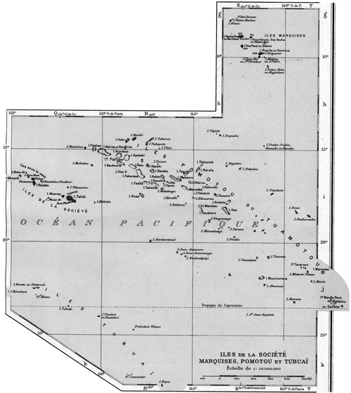
The Society Islands lie between latitude 16˚ and 18˚ S, and longitude 148˚ and 155˚30´ west of Greenwich, and consists of fourteen islands exclusive of islets. They are divided into the Windward Islands, consisting of Tahiti, Moorea, Maitea or Mehetia, and Tetuaroa; and the Leeward Islands, consisting of Tubuai-Manu, Huahine, Raiatea, Tahaa, Bora Bora, Motu Iti, Maupiti, Mopelia, Bellingshausen (or Lord Howe’s Island), and Scilly. (Map of French Polynesia from 1917 Hachette atlas. All the 1890s maps I could find still used many of the English names the white explorers gave the islands when Jenson used the native names.) The Windward Islands were formerly called the Georgian Islands, and the name Society Islands only applied to the Leeward Islands. The latter were independent states until 1888, when they were taken possession of by the French. The area of the whole group is estimated at 580 square miles, and has a population of about 1,800 at the present time. [8] Nearly all the islands (except the few coral islands and islets) closely resemble each other in appearance. They are mostly mountainous in the interior, with tracts of low-lying and extraordinary fertile land occupying the shores all around from the base of the mountains to the sea, and surrounded by coral reefs. The largest islands are abundantly watered by streams and enjoy a temperate and agreeable climate, considering their location in the tropics. Almost every tropical vegetable and fruit known is grown here; but agriculture is neglected. The native inhabitants belong to the Polynesian race and resemble the Sandwich Islanders very much in character and disposition. They are affable, ingenious, and hospitable, but volatile and sensual. The women of Tahiti are represented by many as being the prettiest met with on any of the Pacific Islands. The practice of tattooing has almost wholly disappeared, and many of the natives pattern now after Europeans in their dress, especially the women, who are now generally in full dress and only show their bare feet and usually uncovered head. The men wear only a shirt and a breechcloth, the indispensable pareu, on ordinary occasions. Copra (dried coconuts), oranges, and lime juice are the principal articles exported. The Tahitian oranges are supposed to be the best in the world. Copra is the general article of barter throughout the islands for groceries and general merchandise, which are imported chiefly from America, France, and New Zealand; but the natives could easily subsist without these imported wares, as the islands produce everything necessary to sustain life, including breadfruit, bananas, fei plantain, yam, sweet potatoes, taro, etc. Both French and Chilean money is used. Taxes and customhouse duties are paid in French money, but Chilean money is used almost exclusively in trade. A Chilean dollar is worth less than half a United States dollar; it is taken at par value with two English shillings and two and a half francs. The denominations in use here are ten cents, twenty cents, fifty cents, and one dollar pieces—all silver. The animal kingdom of the Society Islands is represented by horses, cattle, sheep, goats, hogs, dogs, and fowls, etc. Most of these species were originally imported by the whites.
Tahiti is by far the most important island of the group. It is about thirty-two miles long from northwest to southeast and is an elongated range of high land, which, being interrupted in one part, forms an isthmus about three miles wide which connects the two peninsulas. From a low margin of seacoast, the land rises to a very considerable height on both extremities of the island, where some high fertile valleys intersect the ranges at different parts. The loftiest mountain on the northern peninsula is Orohena, 7,339 feet high. The next in point of elevation are Pito Hiti, 6,996 feet, and Vaorai, 6,771 feet. This last-named mountain is sometimes called the Diadem. From these lofty peaks, ridges diverge to all parts of the coast; they are precipitous and generally narrow, in places a mere edge. The island is nearly surrounded by an excellent broad road called the Broom Road, which, overshadowed with trees, affords a delightful means of visiting the different settlements distributed around it. The code of laws adopted by the Pomares in early days, the punishment for getting intoxicated was making so many feet of this road. Outside the low belt of land at the foot of the mountains, a coral reef encircles the island at a distance of from one-fourth mile to three miles; and within this are several excellent harbors. Tahiti is decidedly a beautiful island and is sometimes called the Eden of the Paape. It is sufficiently high to be seen at forty-five miles distance at sea. Approaching it from the northeast or southwest, it looks like two islands, the low connecting isthmus not being seen. The natives distinguish the two peninsulas of which Tahiti is composed by the names of Opoureonu, or Tahiti Nui (Great Tahiti) and Tiaraboo or Taiarapu or Tahiti Iti (Little Tahiti), united by the isthmus.
Captain Cook in his description of Tahiti, or Otaheite, as he called it, on the occasion of one of his visits, says: “Perhaps there is scarcely a spot in the universe that affords a more luxuriant prospect than the southeast part of Otaheite. The hills are high and steep and in many places craggy; but they are covered to the very summits with trees and shrubs, in such a manner that the spectator can scarcely help thinking that the very rocks possess the property of producing and supporting their verdant clothing. The flat land which bounds those hills toward the sea, and the interjacent valleys also, teem with various productions that grow with the most exuberant vigor, and at once fill the mind of the beholder with the idea that no place upon earth can outdo this in the strength and beauty of vegetation. Nature has been no less liberal in distributing rivulets, which are found in every valley, and as they approach the sea, often divide into two or three branches, fertilizing the flat lands through which they run. The habitations of the natives are scattered without order upon these flats; and many of them appearing towards the shore, presented a delightful scene viewed from our ships especially as the sea within the reef which bounds the coast is perfectly still, and affords a safe navigation at all times for the inhabitants, who are often seen paddling in their canoes indolently along in passing from place to place, or in going to fish. On viewing these charming scenes, I have often regretted my inability to transmit to those who have had no opportunity of seeing them such a description as might in some measure convey an impression similar to what must be felt by everyone who has been fortunate enough to be on the spot.” [9]
Tahiti had 10,113 inhabitants in 1892, of which 4,288 resided in the city of Papeete; the area of the island is 260,000 acres.
Moorea situated about nine miles northwest of Tahiti ranks as one of the loveliest islands of the Pacific, and the harbor of Talu, near Papetoai, is one of the best in the world. The water is so deep close to shore that ships can be tied to a tree on the land. Moorea is a beautiful object as seen from Tahiti, and its beauty is enhanced on a nearer approach; its hills and mountains may, without any great stretch of imagination, be converted into battlements, spires, and towers rising one above the other, and their great sides are clothed here and there with verdure, which at a distance resembles ivy of the richest hue. Moorea has, if possible, a more broken surface than Tahiti, and is more thrown up into separate peaks; its scenery is wild, even in comparison with that of Tahiti, and particularity upon the shores, where the mountains rise precipitously from the water to the height of 2,500 feet. The reef which surrounds the island is similar to that of Tahiti and has no soundings immediately outside of it. Black cellular lava abounds, and holes are found in its shattered ridges, among which is the noted one through which the god ‘Oro is said to have thrust his spear. The inhabitants of Moorea reside upon the shores, and there are several large villages on the south side of the island. By the census of 1892, the inhabitants numbered 1,497. Coffee, cotton, sugar, and all other tropical plants succeed well in Moorea. The island lies in a triangular shape, of which the north side, which runs nearly due east and west, is about nine miles long. The southeast coast is nearly seven, and the southwest eight, miles long. Its area is about 32,710 acres, of which 8,650 are fit for cultivation.
Moorea was discovered by Captain Wallis July 27, 1767, and by him named Duke of York Island.
Maitea, or Osnaburgh Island, is the easternmost of the Society Islands and lies about sixty miles east of the east end of Tahiti, or about one hundred miles from Papeete. The island is high, round, and not more than seven miles in its greatest extent; its greatest elevation is 1,597 feet, and it is in latitude 17˚52´ S; longitude 148˚51´ W. Its north side is remarkably steep. The south side, where the declivity from the hills is more gradual, is the chief place of residence of the natives; but the north side, from the very summit down to the sea, is so steep that it can afford no support to the inhabitants. The eastern part is very pleasant, coconut and other fruit abounding. There were a number of Saints on this island at an early day but none now as far as known.
Tetiaroa is a small, low island, or rather a group of small, low coral islets enclosed in a reef about thirty miles in circumference, lying twenty-four miles north of Tahiti. They formerly belonged to Queen Pomare, of Tahiti, and were inhabited by the poorer people who subsisted on fish and coconuts. The latter still abound. Tahitian ladies of rank made this place one of their favorite resorts, going there, as they said, to improve their complexion by reposing beneath the shade trees; but more frequently, it is supposed that they go to recover from diseases brought about by licentious habits.
Tubuai Manu, or Maiao Iti, formerly also known as Sir Charles Saunder’s Island, is the shape of a foot, hence one of its names, as maiao is “foot” in the Tahitian tongue and iti is “little.” This island is composed of many little islands which gradually have been joined together through the process of nature to make one island, which is about thirteen miles in circumference; its greatest length from east to west is about six miles. In the center a hill, about 160 feet high with a double peak, rises, but the great portion of this land is fertile, and the lower ground abounds with coconut trees. The hills are wooded to the summits, and at a distance the island has much the appearance of a ship under sail. The northeast point is in latitude 17˚38´ S, longitude 150˚ 33´ W, is about fifty-five miles west of Tahiti, and has about 200 inhabitants. It was discovered by Captain Wallis July 28, 1767.
Huahine (Vahine “woman”) is the easternmost of the group, which was called the Society Islands by Cook, who discovered it in July 1769. It is situated about ninety-five miles northwest of Tahiti, is about twenty miles in circumference, and is divided into two peninsulas, called respectively, Huahine Nui, or “large,” and Huahine Iti, or “small.” A strait with shallow water less than a mile wide separates the two islands. Huahine has a very narrow strip of fertile land near the shore, and the mountains, which are not nearly as high as those of Tahiti, more strongly indicate volcanic action and are in some parts cultivated. On each side of the narrow strait separating the two islands the rocks, in many places, rise perpendicular from the water. Owhare Harbor, which was visited by Cook a number of times, is situated on the northwest part of the island. It was here that he, on his last visit, left Omai, the Tahitian native, who had attracted so much attention in England. Huahine formerly belonged to Tamatoa, the king of Raiatea, and was given by him to his daughter, king Pomare’s sister-in-law.
Elder Noah Rogers, one of the first Latter-day Saint Elders sent from Nauvoo, Illinois, to preach the gospel to the Pacific Islanders, came to Huahine in his calling as a missionary in the latter part of 1844; but the people would not receive him. After being rescued from the Scilly Island, on the occasion of the wrecking of the bark Julia Ann in 1855, Elders John S. Eldredge and James Graham, returning to America from missions to Australia, spent about a month at Huahine, waiting for the schooner Emma Parker to get ready to take them to the Sandwich Islands. Undoubtedly they did some preaching at the time. This was in January 1856.
Raiatea, or Ulietea, lies about twenty-five miles to the westward of Huahine and 120 miles northwest of Tahiti. It is about forty miles in circumference, of a mountainous character, is covered with vegetation, and is but too well watered, with cascades, rivers and swamps abounding in all directions. At a distance of one or two miles from the shore, the land is encircled by a coral reef that also encloses the adjacent island of Tahaa. This reef has several small islets on it. Raiatea has seven excellent anchorages on the weather and lee side of the islands. The best of these is the Uturoa Harbor on the northeast coast. It is a reef harbor and has two or three entrances. The soil of the island is exceedingly fertile; exotic fruit trees thrive vigorously, and particularly the fruit of the lime. Raiatea is a beautiful island indeed. Among its historic localities is a valley by the seaside called Opoa, where the chief temple and image of ‘Oro was situated in the days of old. To this place the inhabitants of some of the other islands flocked to offer sacrifices to their god ‘Oro. They brought with them the putrid bodies of persons, who had been hung on trees in their own islands, and left them to be consumed in Opoa. Near this valley is a large cave, the bottom of which has never been found. This place was called “poor night” by the natives, and was supposed to be the place of departed spirits. There is a legend among the people to the effect that a cruel king of Raiatea, who was curious to examine this cave, ordered his subjects to let him down by a rope. They obeyed; but when they found their chief in their power, they let go the rope and left him to perish.
Elder Noah Rogers visited Raiatea as a missionary in 1844 but was rejected by the people. Elder John McCarthy immigrated to America from Australia, visited Raiatea late in 1855, or early in 1856, after being shipwrecked in the ill-fated Julia Ann on the Scilly Island. He remained two weeks and baptized a Spaniard by the name of Shaw whom he ordained an elder, but what became of that elder I have been unable to learn.
Tahaa, which is forty miles in circumference, is sometimes called the twin sister to Raiatea, as it is enclosed in the same coral reef. The water between the two islands is smooth and only about two miles in width, and both are surrounded by a great number of anotus, which rest upon the coral reef. Tahaa is about half the size of Raiatea and is not so fertile. Captain Cook visited this island in his boats in 1773; and Lieutenant Pickergill was sent around it by him in a boat in 1773.
Bora Bora is distinguished by a very lofty double-peaked mountain, which rises in the midst of and reaches far above the surrounding hills. It is crowned by a square piece of rock which appears as if placed there by human hands, though no human foot has ever reached the summit. Bora Bora is about eight miles northwest of Tahaa, to which it is inferior in extent, but the reef with which it is surrounded is nearly full of islets, much larger than those which are scattered among the rocks that enclose Raiatea and Tahaa. Bora Bora is more rude and craggy than the rest of the Society Islands. Its eastern side has a barren appearance, the western is more fertile; a low border which surrounds the whole, together with the islands on the reef, are very productive. Its earliest inhabitants are said to have been malefactors, banished from the neighboring islands. Caption Cook did not land here upon his first or second voyage, and in 1777 he was prevented from anchoring in the harbor by contrary winds. On its west side is Vaitape, the port of the island, to which the distance from Tahiti is about one hundred and fifty miles.
Bora Bora, as well as Huahine, Raiatea, and Tahaa, was visited by Elder Noah Rogers in the latter part of 1844; but the natives, influenced by sectarian ministers, would not receive him as a Latter-day Saint missionary. I believe no attempt has been made by any of our Elders to preach on Bora Bora since 1844. According to French official reports, the island of Bora Bora has about 600 inhabitants at the present time. Huahine has about 1,300 and Raiatea and Tahaa together about 3,000 inhabitants.
Motu Iti is the northernmost of the Society Islands proper and consists of some very small, low islets, connected by a reef, about ten miles north northwest of Bora Bora, to which it belongs. It has no permanent inhabitants; turtles abound.
Maupiti, or Marua, is the westernmost of the Society Islands proper.
It is forty miles northwest of Raiatea and is distinctly visible from the lower hills of that island. It is about 170 miles northwest of Tahiti. The island is composed of hills wooded to their summit and occasionally crested by coconut trees but presenting ragged and mural cliffs to the seacoast, especially one rocky mass on the southwest side, which rises 700 feet above the sea, resembling the ruins of a gigantic castle. The population of the island is small; the principal village is situated on the southeast side. The island is surrounded by a coral barrier reef at a distance of about three miles, enclosing numerous small islets covered with coconut trees. The island, which is seldom visited by foreign vessels, is in latitude 16˚26´ S, longitude 152˚12´ W.
On learning of the disaster of the Julia Ann on the Scilly Island reef in 1855, the king or chief of Maupiti, in response to a petition by Elder John McCarthy and others, dispatched two little schooners to the Scilly Island for the purpose of talking off the castaway “emigrants,” but on arriving there they found that Captain Pond, who had chartered the schooner Emma Packer at Huahine, had been there twelve hours before and had taken the people away. Elder McCarthy then returned with the schooners to Maupiti, where he commenced to preach the gospel. He found favor with the King Tapor and baptized the king’s interpreter, Captain Celano, a Maltese by birth, who could speak seven languages. Brother McCarthy ordained this man an elder and was enabled through him to preach the gospel to the natives, who seemed favorably impressed by his testimony. After about three weeks’ stay on Maupiti, Elder McCarthy sailed for the island of Raiatea. This was in December 1855.
Scilly Island consists of a number of very low islets, or motus, lying on a coral reef which measures about fifteen miles in circumference. The easternmost motu is in latitude 16˚28´ S, longitude 154˚30´ W, or about 185 miles west from Raiatea and 300 miles northwest of Tahiti. Besides the circular reef composing the island, a hidden reef extends in a westerly direction for many miles, and the whole reef system constitutes a very dangerous locality for navigators. It was on the hidden reef on the west and about twelve miles from the island reef that the ill-fated bark Julia Ann en route from Australia to America with a company of Saints was wrecked October 3, 1855. On that sad occasion two women and three children were drowned and the survivors compelled to spend several weeks (most of them just two months) on the uninhabited island subsisting on turtle and brackish warier. They were finally taken off by the Emma Packer, a schooner, which Captain Pond had chartered for the purpose at Huahine. The Scilly Island was discovered by Wallis in 1767.
About fifty miles southeast of Scilly Island lies Mopelia, another coral island about ten miles long by four broad, discovered by Wallis in 1767; and about forty miles northeast of Scilly is Bellingshausen Island, which is also a low, uninhabited coral island, triangular in form and richly covered with tropical vegetation. These three last-named islands do not properly belong to the Society group, but as they belong to no other group geographically and they are now classed as French possessions and counted by French officials as members of the Society Islands, I have also described them under that head in this article.
“Jenson’s Travels,” February 22, 1896 [10]
Island of Manihi, Tuamotu Archipelago, South Pacific Ocean
Saturday, February 15. Elder Frank Cutler and I, intent upon a missionary and historical tour to the Tuamotu Islands, boarded the fine schooner Teavaroa, Henry Mervin, supercargo, at 11:00 a.m., and at 12:00 noon we set sail and left the Papeete wharf, island of Tahiti. The wind being contrary and very little of it at that, it took us two hours to get out of the harbor, having to tack a number of times. The American mail vessel Tropic Bird had most of her sails set as we passed her ready to go to sea, but could not get out against the wind. The island of Tahiti and also the neighboring island Moorea, with their grand, lofty mountains, look grand and imposing from the sea. Having cleared the reef at 2:00 p.m., we soon struck the trade wind, which filled our sails nicely and enabled us to take a northeasterly course. There was quite a heavy swell on the ocean which caused everybody onboard who were not sailors to reel and stagger; and, contrary to my fond expectations, I got seasick and fed the fishes several times during my first night on the Teavaroa. In fact Elder Cutler and I spent a miserable night lying on the cabin deck and trying in vain to sleep; it was too warm and sickly in the cabin below.
Sunday, February 16. We had kept a northeasterly course all night, and at 10:00 a.m., we sighted the island of Makatea straight ahead. Failing to make the windward side, we passed its extreme northwest point within a distance of 300 yards at 2:00 p.m., which gave us an excellent opportunity of studying the formation and vegetation of the island. Makatea is an uplifted coral island situated in latitude 15º52´ S; longitude 148º20´ W of Greenwich, or about 125 miles northeast of Tahiti; it is about five miles long by four wide and produces copra, beans, sweet potatoes, etc., which latter products the natives have commenced to import to other islands. Makatea, unlike all the other Tuamotu Islands, is elevated in the center, its highest point being 250 feet above sea level and is covered with a brush called tamanu. The only village on the island is situated on the northeast coast; the inhabitants, numbering about 150, are now nearly all Josephites. The island has recently been visited by Elders Eugene M. Cannon and Alonzo F. Smith, but with what success I do not know at present.
The west coast of Makatea was very interesting to look at as we sailed by; its nearly perpendicular walls rise to a height of about one hundred feet (perhaps more) and they abound with caves and numerous strange formations—the work of corals and the actions of water during the past centuries. After leaving Makatea, we continued our voyage in the direction of Rangiroa.
Monday, February 17. The early-morning hour found us beating off the south coast of Rangiroa, which is the largest of all the Tuamotu Islands extending as it does from northwest to southeast about forty-two miles and is twenty miles wide on an average. Its center is situated in latitude 15º9´ S and longitude 147º40´ W of Greenwich. This island, like most of its sister islands, consists merely of a coral reef, which here and there is covered with trees. Some of these patches are several miles long and from a few yards to half a mile or more in width; but others contain only a few acres, some of them as seen from a distance puts one in mind of a huge bouquet of flowers. The lagoon inside the reef abounds with pearl shells for which the natives dive whenever the lagoon is open for that purpose. Coconut trees are plentiful on this island, and the export of copra amounts to something like 400 tons a year. Rangiroa, which translated means “long heaven,” was one of the islands of the Tuamotu group where Elder Benjamin F. Grouard and other elders at an early day preached the gospel with success, and branch organizations were kept up till about 1885, when the Josephites interfered and caused the natives to identify themselves with their organization.
During the day, Teuira, the Hawaiian captain of the Teavaroa, related the following incident in his life. Sometime in 1882 he sailed from Tubuai bound for Tahiti as master of the schooner Alura Toeran, having twelve souls onboard, including himself, all natives. There were eight men, three women, and one child. The schooner was a vessel of seventeen tons register. After proceeding about 135 miles from the port of embarkation, a terrific whirlwind struck the vessel and capsized her, spilling most of the passengers in the ocean. The captain, not being on duty on time but asleep in the cabin, was not aware of what had happened till he felt his feet and soon his whole body in the water. He made a spring for the cabin door and soon found himself together with nine others sitting on the keel of the vessel, which by this time had turned completely upside down. But two of the women were missing, one of whom was the captain’s own wife. Though they were supposed to be drowned already, Teuira, who like most natives of the Pacific Islands is a good diver and swimmer, dove under the vessel and tried to force his way into the cabin, but as one or more heavy boxes had rolled against the door from the inside he was at first unable to effect an entrance, but succeeded, after diving several times in pushing the door open, when he found the two women standing in water to the neck, being just able to breathe. Bidding one of them to follow him at a time by diving for the door, he succeeded in pulling them out from the interior of the vessel and then helped them to a position on the keel. Thus all hands were saved so far, but how to proceed next was a question of vital importance. Most of the others seemed to have lost their presence of mind and could think of no means of escape from the doomed vessel, but the captain, unaided by the others, set to work to unfasten the little boat which was secured to the deck or rigging of the vessel deep under the water. This he did by diving down repeatedly and stopping under the water as long as possible, working at the ropes. At length his toil was rewarded, and to the great joy of all the little craft, scarcely ten feet long, was floating on top of the water. To bail it out was an easy task; but after eight persons had got into it, it commenced to sink, thus showing that it was altogether inadequate to carry away any more than half of the shipwrecked people, and even that number would by no means be safe in case of stormy weather and a rough sea. Something else must yet be done in order to save all. Though considerably exhausted from his previous diving, the captain renewed his labors under water and succeeded, after going down many times, in unfastening the booms of the ship and bringing them together with some of the sails to the service [surface]. All hands now went to work assisting the captain in constructing a sort of craft by tying the two booms together with three ropes in such a way that the boat occupied a central position between them, being lashed to the timber, and thus prevented from sinking. Secured in this manner, all the people after deciding to make their way to Tahiti if possible, left the capsized vessel at 6:00 p.m. on a Friday evening, the capsizing having occurred in the morning. A woman’s shawl fastened to a short stick or paddle which was raised from the raft served the purpose of a sail, the canvass taken from the schooner having been used to wrap around the boat. Being exposed to the mercy of wind and waves, the unique raft was kept heading in the direction of Tahiti for three days, but as the wind was contrary, that island was about as far off at the end of that time as when they started out. The wind blowing in the direction of Rurutu, it was now decided to change course and head for that island; and after suffering terribly from want of food and water, a single box of oranges being the only eatables secured from the schooner, Rurutu was finally reached on the Saturday, just eight days from the time of the shipwrecking. As the raft was thrown violently against the reef, all the people were cast into the sea, but they had strength enough left to swim to shore, and thus they were all saved. The people of Rurutu treated the unfortunate navigators with great kindness, and after recuperating for several days, they were taken back on another vessel to their own island, Tubuai. As an appreciation of bravery and true merit, Captain Teuira was subsequently awarded a gold medal by the French government, of which he appears to be justly proud.
Tuesday, February 18. Early in the morning the island of Kaukura was seen straight ahead, and we were making good speed towards it when the wind suddenly died out and left us drifting helplessly at sea. About noon, however, a breeze sprang up which enabled us to reach that particular motu, or part of Kaukura which is known as Raitahiti, where some of the people are located temporarily to gather and dry coconuts for the markets. At 2:00 p.m. the ship’s boat was launched, and Elder Cutler and I landed together with a part of the crew who were going to work with the copra. The passage over the reef at this point is a dangerous one, and several accidents have happened of late both to men and boats; but the weather being good, we got safely in. On landing we met a number of natives, who greeted us warmly and invited us into one of their huts, where we were given coconut milk to drink. We then engaged in long conversations with some of the leading men present, among whom were Tetuarere who presides over the Josephite organization on the island of Kaukura. Elder Cutler talked a long time to the people who gathered to see us, and they all seemed very much pleased with what they heard; and when we left, they presented us with two baskets of coconuts and two live chickens. We returned to the ship after sundown.
The island of Kaukura is twenty-six miles long from northwest to southeast, and ten miles broad on an average. Its west point is in latitude 15º43´ S, longitude 146º50´ W, and about 195 miles northeast of Tahiti. It has a boat entrance near the northwest end. About two hundred tons of copra is exported from the island per year. The lagoon also abounds with pearls, but it is closed at present. Among those Elder Cutler and I met onshore—the two white traders of the island—one (Peter Peterson) was a Shaleswick Dane, the other (George Richmond) an American from the state of Massachusetts. No schooner or other vessel from Tahiti having called for a long time, the island had been short of provisions for over two months, and even the traders asserted that they had been without bread for three weeks. All the flour consumed here is imported from San Francisco and is sold by the local traders at the rate of seven Chilean dollars per 100 pounds. Mr. Richmond has married a native wife with whom he has twelve children. The other man simply lives with a native woman.
Wednesday, February 19. The shipping of copra was continued from yesterday, and it took all day before the crew finished their labors. In the evening all the men came onboard, and the ship stood off and on all night as she had done all day. Elder Cutler and I, remaining onboard, spent the day reading and writing. The day was exceedingly hot, and life on the Teavaroa that day was in consequence anything but pleasant. About fourteen tons of copra was taken onboard. Copra has only been known in the Pacific Ocean during the last twenty years. It was first introduced by Godeffroi and company, the well known Hamburg House, who laid the foundation of the German interests in the South Seas. The introduction of copra changed the face of the oil trade and gave a new value to the low atolls, or lagoon islands, which are the coconut’s natural home. The kernel of the nut is dried and sent to Hamburg or other European ports, where the oil is extracted, and the refuse sent as oil cake to England. The cocoa palm loves the sea air, and the salt spray; and on these low atolls it gets both. The absence of grass or other competing growths makes the cost of cultivation small. The cost of gathering the harvest is also easy. The fruit, which ripens on the tree, is collected and husked when it falls; and the kernel, after being dried in the sun, is cut up and loaded in bulk in the ship’s hold. The natives are very skillful in the preparation of copra, and they seem to like the work connected with it.
Thursday, February 20. We awoke early enough to behold the beautiful sunrise, at which time we were only half a mile off Panau, the only village of any importance on the island of Kaukura. At 6:00 a.m. Elder Cutler and myself landed with the ship’s boat, which brought goods onshore. The boat landing here is quite safe, and consists of a break in the reef through which a small vessel can approach the dry sandy beach within one hundred feet or so. As soon as we landed, the inhabitants of the village flocked around to shake hands and bid us welcome, and we were at once conducted through the main portion of the village to the house of Teura, the native trader whom we had met before on the neighboring motu. The principal men of the island soon gathered, or rather followed us there, and we now spent about an hour in lively conversation, telling them something about Church history and showing them views, specimens of rocks from some of our temples, etc., which seemed to interest them very much. When we were ready to leave, some of them made us presents of shells and said they were much pleased with our visit.
The village of Panau occupies nearly the entire surface of the motu known by that name, which is about half a mile long by a quarter of a mile wide and is covered with young, thrifty coconut trees. These have all been planted since the cyclone in 1878, when the entire island was bereft of its fine growth of trees and brush of every kind; also the whole village was destroyed, only one house being left standing, and the ruined condition of that one was pointed out to us as we passed. The most imposing structure of the village is the Catholic church, a stone building surmounted with a little spire, which presents a fine appearance from the sea. The meetinghouse which the Josephites are using is a plain lumber structure with board shutters instead of windows. This also was built after the cyclone, mostly from the material which had been in the former one that was blown down by the storm. The main thoroughfare of the village is lined on both sides with coconut trees, and the houses, many of which are built in European style, lie scattered somewhat irregular on both sides of the alley. Before the cyclone the island contained over two hundred inhabitants; now it has scarcely much above half of that number according to the best information we could obtain, as one hundred persons perished during the storm. This catastrophe need not have happened; but when the natives saw their island almost inundated by ocean water which the terrific wind blowed [sic] over it, and their coconut trees pulled up by the roots or break square over in other instances, some of them seemed to lose their presence of mind and ordinary judgment, as they took to their boats and pushed off onto the lagoon; but of course no boat could live upon the water in such weather, and the consequence was that all those who embarked were drowned, while all who remained on land escaped with their lives, though they lost nearly all their property. No other island of the Tuamotu group suffered in that storm to such an extent as Kaukura, as the center or the heaviest part of the cyclone seemed to strike it with all its force.
Among the natives with whom we conversed at Panau was an old man by the name of Tehopea, who claimed to have met the late Elder Benjamin F. Grouard on the island of Rangiroa about the year 1852, or just before that elder returned to America. He also said that there was a continuous branch of the Church on Kaukura from the time the American elders left till the Josephites came.
About 7:30 a.m. we returned to the ship, which about half an hour later set sail for the neighboring island of Arutua about twenty miles distant. About 10:00 a.m. the treetops of that island were seen ahead; but as the wind was contrary, it took us till late in the afternoon to reach a point off Rautini, the name of that particular motu of Arutua where the village stands and the people live. About 3:00 p.m. the ship’s boat was launched and left for the village. I jumped in at the last moment, but Elder Cutler, who was not through with his toilette, was left behind. As the wind blowed toward the island, the ship dared not go in close to the reef, hence the crew had to row the boat a long distance to the place of landing, and as the sea had a very heavy swell on, the rowing was difficult, and we were tossed about considerably before we got through the passage and reached the stone wharf in front of the village. Here I was in a fix without an interpreter, as the few Saints temporarily located on the island while fishing for shells soon gathered around me at the house to which I was first conducted; but the native brother who was our fellow passenger and who also landed could talk a very little broken English, and I got along, as well as I could with his services. I also introduced myself to Mr. Carl Hanson, a Swede, and one of the traders of the island, from whom I obtained several particulars in regard to the island of Arutua, which is nearly circular in shape and measures about fifteen miles across, lagoon included in most places. The pass which our boat came through is the only passage which connects the lagoon with the ocean; it is deep enough for vessels of twenty or thirty tons’ burden only, and as the current often runs very swift, and it is on the southeast or windward side of the island, the entrance is very dangerous. The little village, which is nearly hidden from sight in the coconut grove, lies on a small motu on the right-hand side as we enter. The reef around the lagoon is pretty well covered with vegetation, except on the west and south, where there is considerable bare reef. Arutua is noted for its fine pearl shells, some of which are marvels for size. In one year alone (1886) fifteen tons of shells were fished out of the lagoon; but this season has been an unsuccessful one and all the transient divers are preparing to leave, as they cannot find shells in paying quantities. The cyclone of 1878 destroyed most of the trees of Arutua; hence the present beautiful growth of coconut trees consists mostly of new plantations. Arutua is about 215 miles northwest of Tahiti. That and the two neighboring islands Kaukura and Apataki were named the Palliser Islands by Captain Cook.
Before I left the village, Marerenui, a brother in the Church, made me a present of a fine pair of shells, and we returned to the ship about sundown, reaching it with much difficulty, as the rowing had to be done against the wind and high rolling waves.
Friday, February 21. We had sailed to and fro all night, and when the light of the morning dawned upon us we were coasting along the west line of Apataki, but just as the crew was getting the boat ready to go ashore, a drenching rainstorm set in, which continued all day, and thus we were compelled to spend a very dull day in an inactive manner at sea. Several squalls struck the vessel, which somewhat relieved the monotony; but the real excitement of the day was the catching of a large swordfish (on the fish line) which had been following the ship for some distance. The fish, which weighed several hundred pounds and was a beautiful specimen of his kind, was successfully hauled alongside the vessel, where he was speared or harpooned almost to death; but just as the crew, which was considerably excited, was in the act of lifting him bodily onboard, the fish made one last desperate struggle and thus jerked himself loose from the hands that held him and was lost as he sank in the ocean. It was too bad. We could have got him just as well as not had the crew not been so excited that they neglected to secure him with ropes before attempting to haul him onboard. In the afternoon, notwithstanding the rain, Mr. Mervin and part of the crew landed in the boat. On their return it was decided to sail at once for the island of Manihi, distant about sixty miles in a northerly direction. Consequently, about sundown we set sail for that island, and the wind being favorable and the weather now being good, we sped toward Manihi at the rate of ten miles an hour during the night.
“Jenson’s Travels,” February 29, 1896 [11]
Teavaroa, Takaroa, Tuamotu Islands
Saturday, February 22. Sometime after midnight, the Teavaroa arrived in the vicinity of Manihi, after which she “stood off and on” till morning, when we approached the passage by the village. The boat was lowered, and among those who landed were Elder Cutler and myself. The inhabitants, who were nearly all Josephites, were out in force and lined the stone wharf as we landed. After the usual handshaking all around, we were conducted to one of the houses, where the people gathered around, and a long religious conversation was soon commenced and kept up for hours. Wirimau, a native Josephite missionary of considerable ability, took his side of the question of succession but was badly whipped on every point, which he himself acknowledged, as he was confronted with such historical evidence as he had not known before. Judging from his statements, the white Josephite missionaries, in order to carry their point with the natives in the Tuamotu Islands, have made use of such lies and glaring falsehoods in regard to the true Church as would have put a Missouri mobocrat to shame in the thirties. Shame to such a mode of procedure! These poor natives, who for so many years had been left to themselves without a single elder from America to advise them, were not in a position to judge as to the correctness of what they were told by these emissaries, who represented themselves as elders of the same church to which Elders Addison Pratt, Benjamin Grouard, and co-laborers belonged. But they no doubt forgot to tell that their so-called Reorganized Church did not have an existence till 1860, while Elder Pratt and his companions representing the true Church performed their missionary labors on the Pacific Islands from 1844 to 1852.
One instance was related to me by Elder Cutler where some money was gathered by the natives for missionary purposes. Both our elders and the Josephite missionaries were represented. When a donation is made by the natives, it is customary for the leading men to make a little speech explaining the donation about to be made and the motive that has prompted the same. On the occasion referred to, the man who made the speech was very particular to explain that the donation was intended for the representatives of that same church which Elder Addison Pratt and companions had established upon the islands. Upon which the Josephite preacher deliberately stepped forth and claimed the money, got it, and kept it. If this is not getting money under false pretenses, I would like to know what is! The Josephites on Manihi are making great preparations for holding a conference there in April. They have built a large eating house, and expect a great feast on the occasion. They claim a membership of 102 on Manihi, which are nearly all the inhabitants of the island. Elder Cutler and I returned to the ship for dinner with the boat, which was landing merchandise and shipping copra; but we landed again in the afternoon, when we took a long walk around the motu on which the village stands and also looked for shells on the seashore. Returning to the village, we had another long conversation with Wirimau and others and went onboard with the last boat just after sundown. Soon after that we sailed toward the south, returning to Apataki. The wind was again in our favor, and we made good time. The moon beamed beautifully upon us, and the voyage was pleasant.
The island of Manihi (also called Waterland Island) is sixteen miles long from southwest to northeast and six wide; its east end lies in latitude 140º23´ S; longitude 145º52´ W. It is also sixty miles west of Takaroa; ninety miles northwest of Rotoava, Fakarava; and 280 miles northeast of Tahiti. The coral reef at the west end of Manihi is quite broad; some of the motus are half a mile wide and several miles long and well covered with coconut trees. The boat passage where we went in and out is near the west end of the island on the south side; it is the only passage leading from the ocean to the lagoon.
Sunday, February 23. About 1:00 in the night, we had arrived off the coast of Apataki, which island lies about twenty miles northeast of Kaukura and twenty-five miles southeast of Arutua, and we now stood off and on till morning. About 8:00 a.m. we passed through a narrow passage between two motus on the west side of Apataki, and near the north end of the island, into the lagoon; thence the ship turned to the left and cast anchor close to a motu, where the ship’s boat landed with thirteen of the natives, besides Elder Cutler and myself. While we elders took a bath in the ocean and read from our books under the shade of a coconut tree, the natives gathered about 300 dozen kavaka eggs, filling eleven or twelve good-sized boxes and barrels. This bird, which is considerable smaller than an ordinary pigeon, is very plentiful on some of the Tuamotu [Islands]. Its eggs are spotted and exceedingly large (nearly the size of chicken’s eggs) for a bird of that size; and each bird only lays one egg at each breeding season, which it deposits in the coral sand in places where the brush growth is small and scattered. This being the season for hatching, the islet seemed literally covered with eggs, and as the natives approached with their boxes and barrels, bent on robbing the poor birds, these flew up by the tens of thousands and then kept flying to and fro overhead until the sun was virtually darkened by their great numbers; and some of them while making hideous noises came in uncomfortably close proximity to the heads of those who were willfully destroying their prospects of offspring. Some of the birds, which are good for eating, were killed by the sailors, who also caught some fish and gathered a quantity of coconuts to take onboard.
After spending about three hours on the uninhabited islet, we returned to the ship about 3:00 p.m. Soon afterwards anchor was weighed, and we sailed back to the ocean the same way that we came and now spent the remainder of the day and the following night sailing to and fro off the west coast of Apataki.
Monday, February 24. Early in the morning Elder Cutler and myself landed with the ship’s boat at Pakaka, the only village on the island of Apataki. Here we met Mr. Luther Devore, a Josephite missionary, and wife. They are from the state of Ohio. We had a long and spirited but friendly conversation, and I found Mr. Devore more consistent and reasonable than most Josephite missionaries that I have conversed with. If he is sincere and honest in heart as he claims to be, he is not apt to remain a Josephite all his days. He did not believe that the church organized by Joseph Smith the Prophet in 1830 was rejected because of polygamy but for other causes; and when I showed him the absurdity of some of these causes, he gave in and agreed with me in that it certainly did not appear reasonable that God, full of love and long-suffering, and who bore so patiently with the children of Israel and the Nephites of old, would be so hard on his children in the last days as to reject a whole church indiscriminately merely because a few men in it appeared to do wrong when it was an acknowledged fact that the great majority were striving to the best of their ability to do right. He laid great stress upon the fact that the Nauvoo Temple was not finished but acknowledged that even that taken as a chief cause of rejection did not seem to be consistent. For who but God himself is to determine what He means by a reasonable time to finish a temple in? Are the facts that enemies came upon the temple builders and drove them away from their home not to be considered? And after all, was not the temple finished? The answer can be given both in the affirmative and the negative. It was finished sufficiently for blessings to be given in it, and duly dedicated. But if finished means the last coat of paint in the last room and the highest possible polish and finish that can be put on a building on the inside as well as on the outside, then the Nauvoo Temple was never finished; nor was the Kirtland Temple, nor any other public building (so far as that is concerned) that I know anything about. But if the Church was rejected because the Nauvoo Temple was not finished, then it must have been rejected in the days of Joseph Smith and not afterwards; for it is a historical fact that from April 6, 1841, when its cornerstones were laid, until the martyrdom of Joseph Smith on June 27, 1844, a period of nearly three years and three months, the temple walls were only raised to the windows of the first story; while from the time of the martyrdom till May 24, 1845, when the capstone was laid, a period of about eleven months, the rest of the walls were built and completed under the direction of Brigham Young and the other Apostles. Then the roof was put on, the attic story and tower built, and the temple finished sufficiently to be publicly dedicated May 1, 1846. This proves that if there is any blame attached to anyone for not pushing the work forward on that building fast enough, it belongs to a date prior to June 27, 1844; for after that the work progressed so fast and incessantly that people generally were astonished and the Illinois mobocrats alarmed. I claim that it is simply absurd to charge Brigham Young and the Church after Joseph’s death with any neglect in regard to the building and finishing of the Nauvoo Temple, and it is doubly absurd to think that the Lord would reject a whole church, numbering at the time more than 50,000 people, because a certain stone building was not built as quick as might have been the case had everybody put forth their best efforts. Nor is there anything in the revelation of January 19, 1841, [12] nor in any other revelation that will justify any sensible person in coming to any such conclusion.
Mr. Devore is the head of Josephite missionary operation in the South Sea Islands. Besides him and wife, there is only one other missionary and his wife in this field, namely, Mr. Chase and companion who came from Rarotonga to Tahiti, together with myself in the Richmond. Mr. Devore said that most of the people on Apataki, about seventy in number, are Josephites; those few who are not belong to the Catholics. We have thus visited four islands (Kaukura, Arutua, Manihi, and Apataki) where the Josephites have decoyed the people (who had been true and faithful for many years) from the true fold. I feel confident, however, that it will only be a question of time till most of them will return. In fact, the natives don’t know what they have done, and most of them are apparently incapable at present of realizing their true position, as they still seem to think that they are members of the original church, notwithstanding their baptism into the other one.
The island reef of Apataki is triangular in shape and embraces a large number of motus, covered with trees and other vegetation. Its western shore runs nearly due north and south. There are two passages through which vessels can pass from the ocean into the lagoon, both on the west side of the island. The village lies by the south pass on a small motu containing less than twenty acres of land, where a stone wharf has been built. Pearl fishing in the lagoon is quite dangerous, on account of the many sharks that infest it.
At 12:00 [p.]m. Elder Cutler and I returned to the ship together with about seventy natives who were returning from their diving on Arutua to their more permanent homes on Takaroa and other islands. Most of them were members of the Church, and just before stepping onboard the boats to go to the ship they gathered on the beach, where they sang a hymn, after which one of the native elders stepped to the front and offered up a short and appropriate prayer, invoking the blessings of God upon us all during our voyage to Takaroa. After getting all the people onboard, together with a lot of canoes and one quite large sailing boat, and tying two large boats behind, the Teavaroa set sail for Takaroa ninety miles distant about 2:00 p.m. We passed around the south end of Apataki, but as the usual trade wind prevailed, the progress was slow as we had to beat against it going east. The island of Kaukura was visible toward the southwest. We had evening prayer onboard, and the weather was pleasant all night.
Tuesday, February 25. We were beating against the contrary wind all day and made but slow progress toward our destination. In the morning Toau, an uninhabited island belonging to the people of Fakarava, was seen on our right. We spent the evening singing and in listening to the melodies of the natives, who kept up their inharmonious selections till a very late hour.
Wednesday, February 26. We experienced almost a perfect calm, and the ship made next-to-no heading at all during the day. In the evening the natives caught a shark weighing about seventy pounds. I was given a jaw as a relic, and the natives had a good feast on the flesh, which, together with the kavaka eggs gathered on Apataki and boiled rice, was the principal diet of the seventy-odd passengers during the voyage.
After evening prayer, Elder Cutler addressed the Saints on the evidence of the existence of God. We also sang hymns and songs and enjoyed a good night’s rest on deck, where the moon “smiled” on ship and ocean with all its tropical loveliness.
Thursday, February 27. What little wind we had last night was favorable, and we made good headway toward the northeast. In the morning the island of Takapoto was seen against the eastern horizon and later in the day we were sailing along its northwest coast. This island, which is twelve miles long from northeast to southwest with an average width of five miles, lies about ten miles southwest of Takaroa and 340 miles northeast of Tahiti. The reef is nearly covered with motus (some of them several miles long) except a portion of the southeast side. The lagoons abound with shells, and the village, which contains a school, ranks as one of the prettiest in all Tuamotu. The inhabitants number about seventy who are nearly all Josephites. A flourishing branch of the Church was raised up here by the late Elder Alvarus Hanks, which branch had a continued existence till the Josephites came.
Beating continually against the headwind, we found ourselves within a mile of Teavaroa, the name of the village on Takaroa, about 4:00 p.m., when the wind died out entirely, and we were drifting slowly away from the mouth of the passage with the current. The ship’s boat was landed, and the crew by rowing very hard succeeded in pulling the schooner very slowly toward land; a favorable breeze finally sprang up and helped us in. When near the reef, a number of the native passengers sprang overboard and swam to the reef pulling rope after them, and when once standing firmly upon the reef they walked along and pulled the ship up to the wharf, where we were safely secured by 6:00 p.m. We had been twelve days coming from Tahiti, a distance of about 420 miles by way of the islands visited; but in beating against the wind as we had done, we had sailed at least 700 miles. On landing on Takaroa, we shaked [sic] hands with nearly all the inhabitants who had been left on the island. They came down to the wharf to see the schooner come in and welcome their relatives and friends who were returning home. The natives who had come with the ship gathered on the wharf, where they again sang a hymn and offered up a prayer of thanksgiving before proceeding to their respective homes in the village. This devotion is nearly always attended to by the Tuamotu Saints when they leave and arrive at the different islands that they visit.
After taking supper onboard, Elder Cutler and I went into the village and attended a native gospel school in the meetinghouse. After the regular exercises were over, we both spoke a few words by way of greeting the Saints and then went to the elegant home of Brother Mapuhi, where a comfortable little room was assigned to our use, and here for the first time since my arrival in the Society Islands Mission I slept in a real bed. While in Tahiti, we had slept on the floor in our rented cottage, and on the schooner we had slept on the hard deck. How thankful we felt for our safe arrival at this island, where there is a good branch of the Church, and where we expect to spend a few days.
“Jenson’s Travels,” March 8, 1896 [13]
Rotoava, Fakarava, Tuamotu Islands
Friday, February 28. After enjoying a good night’s rest in Mapuhi’s house on Takaroa, Elder Frank Cutler and I prepared to spend the day in our little room engaged in historical labors; but soon a representative from the few Josephites on the island called on us and desired us to accompany him to the house where they hold their meetings. On our arrival there, we were greeted with a nice little speech and presented with two live chickens and two baskets of coconuts. Soon after returning to Mapuhi’s house, a delegation from our own Church waited on us and conducted us to a dwelling where a number of Saints had gathered. A speech of welcome and a presentation of a small pig, a number of chickens, and several baskets of coconuts were next in order. Elder Cutler responded in a little speech for both of us, having done the same in the Josephite meeting. All the food was sent to Mapuhi’s house, where we, according to appointment, met with half a dozen old men, three of whom had been personally acquainted with the late Elder Alvarus Hanks, but the natives on the Pacific Islands seem to have no conception of dates, so we obtained only a very little information from them. At 4:00 p.m. we attended the regular Friday testimony meeting with the Saints, at which Elder Cutler and several natives were the speakers. Just after the meeting closed, a genuine tropical rain storm commenced and lasted nearly an hour. So violent was the descent of water from the clouds that the thought occurred to me that had the island not been based on a good solid coral rock foundation, it would surely have been washed in the ocean. In the evening Brother Mapuhi, who had been away planting trees on another part of the island, returned home, and we had a long conversation with him. He ranks as the leading businessman on the Tuamotu Islands; he owns three schooners and stores on nearly all the principal islands. Since the reopening of the mission in 1892, he has given our elders free transportation on his vessels and provided a good home for them whenever they have stopped at Takaroa. The French officials at Tahiti call him the king of the Tuamotus. He is a half-caste.
Saturday, February 29. We spent the day gleaning historical information from all possible sources pertaining to Takaroa and its ecclesiastical history. The island of Takaroa is about eleven miles long from southwest to northeast and five miles wide on an average. The only village on the island which is called Teavaroa covers all of a small motu containing only about thirty acres of land; this lies on the northwest side of the island on the north side of a narrow passage (through the reef) which is deep enough for smaller vessels to pass in and out. A substantial stone wharf has been built in front of the village about halfway through the passage coming in from the ocean. The houses of the village are generally neat cottages built in European fashion, and some of them are very comfortable and even stylish, Mapuhi’s house being the best of them all. Nearly all the buildings are surrounded with verandas, or porches, which are so essential for comfort in a tropical home. The streets are laid out regularly so as to conform to the shape of the motu; and the whole town plat is covered with a thrifty growth of beautiful coconut trees. In all matters pertaining to progress and improvements, Mapuhi is the leading spirit. The center of the island of Takaroa is situated in latitude 14º27´ S, longitude 144º55´ W of Greenwich. It is about 350 miles in a straight line northeast of Tahiti, and 100 miles north-northeast of Fakarava.
Takaroa was seen by the navigator Roggeveen in 1722, when Cook subsequently discovered that and the neighboring island. Takapoto he named the two King George Islands; but this appellation is ignored by the French. The first Latter-day Saint elder who preached the gospel on Takaroa was the late Alvarus Hanks. Accompanied by a native elder, he first arrived at the island in 1851, being sent from a conference held at Anaa in August 1851, agreeable to the request of some of the leading men of Takaroa and Takapoto who attended said conference and some of whom were baptized on that occasion. Elder Hanks, on his arrival, was well received by the people, and he soon baptized most of the inhabitants of both islands and organized them into branches of the Church. He made Takaroa his headquarters, and from there he made successful missionary tours to other islands. Elder Hanks left a good name behind him and is remembered as an industrious man who not only preached but by example showed the natives how to make their homes comfortable and to take proper care of their animals and other property. In the first organization of the branch on Takaroa, Marere Tepo was made president. In due course of time he was excommunicated from the Church for drunkenness, and Maru succeeded him about 1870. Maru perished in the great cyclone of 1878 while on a visit to the island of Kaukura, after attending conference at Fakarava. Pehutinui was the next president. He acted till October 9, 1890, when Tearike, the present incumbent of the office, was appointed president at a conference held at Temarie, Anaa. During all these years, meetings were held regularly and Church matters attended to as correctly as the natives understood them. When the Josephites came, they were not received, as the natives doubted the correctness of their statements, and the Saints now rejoice that they did so, as the Takaroa Branch is one of the few branches of the Church in the Tuamotus which remained firm and did not yield to the Josephite delusions. When Elders Joseph W. Damron and Thomas Jones arrived in Takaroa November 1, 1892, they found a branch of the Church numbering about 100 members. Its present numerical strength is 130, including children. This constitutes the great majority of the permanent residents of the island; the few others are Catholics and Josephites. The Saints are engaged in erecting one of the finest Church buildings on the Tuamotu Islands. (Photo of Takaroa chapel) The coral rock walls were completed in September last and are now waiting for the roof. The building is 69 feet long by 34 wide, and 20 feet high to the square. Meetings are now held in a smaller house built in native fashion with thatched roof.
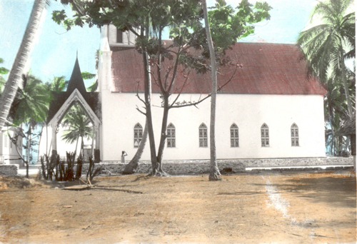 Takaroa chapel. O. Rudeen Allred, missionary journal.
The islands and archipelagoes in the Pacific Ocean are susceptible of classification into three well-marked types, namely, first the atoll, or lagoon island; second, the raised coral island; and third the high mountainous island. Darwin, Dana, and other eminent scientists have expounded the following theory of the formation of atolls and raised coral islands: During the long ages, past and gone, as the land of the traditional Pacific continent was imperceptibly sinking, “the reef building polyp raised its great bastion on the mountain flanks and kept pace with the slowly submerging mass. The combined movement ended in the formation of the great reef, an eternal movement of the mountains buried beneath the waters of the lagoon which it encloses. On the tops of the mountains, as they sank beneath the lagoon, the coral continued to build, forming the rock patches of greater or less extent characteristic of them all.” [14] The raised coral island, according to the Darwin theory, is the only atoll with a shallow lagoon gradually filled with coral debris, and the whole elevated by submarine forces until a solid island, never exceeding 100 to 200 feet at its highest point, was the result. These theories were based on the belief that the reef-building polyp cannot exist at a greater depth than 120 feet, can flourish only in water of the greatest clearness and purity, and must have a solid rock foundation for its infant home. But modern geology disputes the Darwinian theory of coral formation, and a new theory has been advanced through the researches of Mr. John Murray, naturalist of the British government steamship Challenger, and strengthened by subsequent discoveries made by others. The new theory is held to meet the ascertained facts more naturally and more completely,” but as I have no scientific works by me treating upon this matter I am unable to explain the theory to the readers of the News at present.
“The name Atoll is of Maldive origin.” According to a book written by Honorable Frederick J. Moss, now British resident of Rarotonga, “The potentate who rules over the Maldive group styles himself ‘Sultan of the Thirteen Atollons and Twelve Thousand Isles.’ In one sense the title is only a mild Oriental exaggeration, each consisting of a saltwater lagoon and a number of islets—sometimes a very large number—strung together at irregular intervals on the narrow surface of the surrounding coral reef. The islet-covered reef hems in the deep lagoon, which it has cut off from the surrounding ocean. Its characteristic features are the steepness and great depth of the reef-walls and the narrowness, flatness, and low level of the islets formed upon its surface. Few lagoons are less than five miles long and three or four miles broad. The majority are much larger, some being of great size.” [15] Thus the lagoon at Rangiroa, one of the Tuamotus, is forty-two miles long and twenty miles wide. In approaching a lagoon island, it cannot be seen from a ship’s deck in the clearest weather at a greater distance than ten to twelve miles. Even then it is only the tops of the tall coconut trees on the islets that are visible. The land is from six to twelve feet above the sea, as a rule, though occasionally a few feet higher. Approaching the island, the long line of breakers is discerned as the ocean beats with fury upon the outer edge of the massive reef. A narrow brown line gradually coming into view marks the belt of shallow water varying in breadth from one to several hundred yards, covering the surface of the reef between the breakers and the white beaches of pure coral sand which border the islets, or motus (native name), on the reef. The houses of the natives, wherever there are such, peep out from the thick green coconut groves. Let a man walk straight through these groves for 100 to 500 yards, as the case may be, and he will have crossed the motu and find himself facing the deep blue water of the lagoon, with another intervening brown belt of shallow water similar to that on the ocean side of the reef. The reef, which encloses most of the Tuamotu lagoons, are [sic] bare at intervals; in fact, only a small portion of them is covered with islets as a rule. Some of the intervals are fordable so that a person can walk in shallow water from one motu to another, though in many places the sea rolls over them freely into the enclosed area. Some of the motus contain only a few acres of land, while others are several miles long, but seldom attain more than 500 yards at their greatest breadth. “So near the level of the ocean and covered with stately palms, whose crested heads tower above the few trees that find a home among them, the islets scattered on the reef between the deep blue ocean on the one side and the deep blue lagoon on the other, lie like a chaplet of emeralds set in a sapphire sea. The beauty of the coral gardens formed in the clear pools on the seaward face of the reef has been described by many travelers in most glowing terms. They certainly are grand and extremely pleasing to the eye. Assuming every shape of miniature shrub and tree and with fish of dazzling color and varied hue darting to and fro among the branches, these fairy-like gardens, once seen can never be forgotten.” [16]
Fred J. Moss, in his book entitled Through Atolls and Islands of the Great South Sea, published in London, 1889, says, after first describing the inhabitants of the lagoon islands: “Scarcely less interesting is the coral polyp, the humble means through which these marvelous atolls have been created. Secreting from the ocean the time of which their minute frames are built, they lived and died, leaving an innumerable progeny planted on the skeletons of their ancestors to continue the process till, in the course of ages, they formed gigantic bastions of limestone 2,000 feet in depth, with a width at the surface varying from 500 to 1,500 yards. The width at the base must be in proportion to the height, and the gigantic size of the reef may be easily imagined. As it rises out of the ocean the insects perish, poisoned by the air, without which we who inherit their work cannot live. On the narrow surface thus exposed the gales and currents deposit debris and gradually form the detached islets surrounding the lagoon.” [17]
The narrowing of the land makes the climate of the Tuamotus cool and, for a tropical latitude, delightful. The eastern trade winds nearly always prevail but seldom blow very hard. But a lagoon island has quite a few drawbacks. There are no hills, no valleys, no running streams, no land birds, very few flowers, scarcely any grass, and none of the features which in other lands stimulate the imagination and give variety to life. Beautiful as a lagoon island is, its appearance soon becomes monotonous. Nor is this relieved by visiting other islands, for they are so near alike in their formation and physical features generally that after a man has seen one island he has virtually seen them all. In his natural state the wants of the Tuamotu islanders are few. For food he has always the coconut, which is sometimes called the tree of life, as it affords both food and drink. The sea and the lagoon abound with fish, many of them tasteless and insipid to the inhabitants of a colder climate but regarded by the natives as delicious and often eaten raw when caught. They have their feasts of turtle and pigs and, on the whole, lead a joyous contended life, marred only by failures in the coconut crop, petty family or tribal quarrels, or occasional sickness. Formerly, the natives of Tuamotu used no other clothing than their paren, or breechcloth; but now the mean wear a shirt in addition and the women a single skirt and a waist detached as a rule. Their native houses are generally low and small with open sides and thatched with braided coconut leaves. Generally speaking, the people are cleanly in their habits and bath very frequently in salt water. Like other branches of the Polynesian family, they are expert swimmers and divers. The capacity for the latter is especially of value to them when fishing for shells. An expert diver can descend in water fifteen fathoms and remain under water several minutes.
The question of obtaining sufficient fresh water on the Tuamotus has always been a serious one. Frequently the people have suffered for the want of it. In earlier days their chief drink was the cool and bright fluid contained in the green coconut; but the enormous numbers so used materially affected the production of copra which can only be made from the ripe nut, in which the fluid is neither so abundant nor palatable. Hence the use of water for drinking purposes is becoming more common. In order to obtain the necessary supply, ponds are dug out of the coral rock, or hollows cut in the coconut trees and rainwater collected in them. The rocky ponds are also frequently used as bathing places, and the natives, it is said, drink the water without suffering the ill effects which a white man naturally would anticipate. In some islands, groups of all ages may be seen disporting themselves in these stagnant pools, and occasionally one of the number will sweep the scum from the surface and drink a handful of the dirty tepid fluid below.
The water question becomes serious also for vessels cruising through these lagoon islands. European and American traders stationed on the Tuamotus take care to have the roofs of their houses covered with galvanized iron and catch the rainwater as it falls; but the quantity collected is only enough for their own use, and they have none to spare for the supply of shipping. No wonder that the old navigators dreaded these low and incomprehensible islands. Their unsheathed, worm-eaten ships and their scurvied perishing crews could find neither help nor health on these waterless shores. [18]
“Jenson’s Travels,” March 23, 1896 [19]
Point Venus, Tahiti, Society Islands
Sunday, March 1. We attended three general meetings, one gospel school, and a priesthood meeting with the Saints on Takaroa. We also partook of the sacrament, using sprouting coconut meat instead of bread and coconut milk instead of wine or water. The Saints in this mission are “great” meeting goers. In most of the branches they hold three general meetings and a gospel school every Sunday. The general meetings are usually commenced at 6:00 a.m. and 10:00 a.m. and 3:00 p.m. Then gospel schools are held again Monday evenings; testimony meetings and gospel schools Tuesday afternoon and evenings; general meetings and gospel schools on Wednesdays; sisters’ meetings on Thursday afternoons; and gospel schools Friday afternoons and evenings. The elders have tried to cut down the number of meetings, but the natives object, it having become an old habit with them to hold meetings and schools in that order. The exercises in the gospel schools generally consist in questions and answers on gospel subjects, Bible and Church history, etc. The one conducting the school gives the questions out to the several students on a previous school to be answered in the next. These schools are generally interesting and lively, as they stimulate the minds and energies of the natives, who are very anxious to excel in giving correct answers. The elders from Zion, whenever they are present, usually conduct these schools.
Monday, March 2. We spent most of the day culling historical items from some native-kept books, but they contained only a very little which could be of any use to us whatever. As the schooner Hitinui, one of Brother Mapuhi’s vessels, is about to start for Tahiti, I decided to avail myself of the opportunity of returning with it and delegate the remainder of my historical labors to Elder Cutler. I had learned that if I did not take advantage of this chance I might be compelled to stay on the Tuamotu Islands for months and still not be able to visit many of the islands. The natives were making preparations all day for going “inside” (into the lagoon) to fish for mother-of-pearl shells.
On the lagoon side of the reef are caverns and cavities in which the large pearl oysters breed. Attached to the rock by their powerful beard at depths of five to fifteen fathoms, they adhere so firmly that a stout knife is often needed to sever their hold. The pearl shell is itself valuable, and occasionally a rich pearl is found within. That for which Her Majesty (Queen Victoria of England) is said to have paid 6,000 pounds sterling to Storr and Mortimer, came from one of the Tuamotu lagoons.
The earliest records of Spanish conquest in the Pacific are connected with the Pearl Islands in the Bay of Panama. In 1517, only four years after de Balboa first sighted the great sea, Ponce de Leon caused timber to be carried across the Isthmus of Panama and built a small craft with which to make the conquest of the Pearl Islands. The natives were cruelly treated and forced to give up 800 ounces of pearls found in their possession. They were further ordered to pay a yearly tribute of the same quantity. Of course this payment was impossible, as those found in their possession were the accumulated treasure for many years.
Pearl shell in large quantities and of considerable value has always been and is still a product of the Pacific lagoons. About fifty years ago, Commodore Wilkes, in the account of his exploring expedition, refers to the large quantity sent from the Tuamotus, worth then only $45 or $50 per ton. Pearl shell is now in use for purposes then unknown, and the price ranges from $300 to $500 per ton, while larger quantities than ever are demanded. The great difficulty is to get good divers. The diving dress has been tried by Europeans, but the uneven rocky bottom and the oyster’s habit of breeding in caverns or hollows renders the dress unsuitable. Native divers who use no dress or protection around their bodies are indispensable. Their skill is proverbial. They work hard but require long rests at intervals and cannot stand the work of diving for more than a few years altogether.
Tuesday, March 3. Most of the natives left the village in boats for the lagoon inside the island to dive for shells, orders having just been received from the government to open the lagoon for shell fishing. Only five adult members of the church were left in the village, though a few returned again the evening to remain overnight. I spent most of the day measuring off the village and making a plan of it. I also measured the meetinghouse, etc., and finished up my historical labors on Takaroa.
Wednesday, March 4. We arose early and made ready for my departure. About 7:00 a.m., we attended a general meeting with the remaining Saints, at which a native brother and myself were the speakers. After this I called on some of the Saints to say goodbye, among whom were Brother Maruaki and wife, who gave me two fine pairs of shells and a small pearl. Another brother and Mapuhi’s wife also made me presents. We next called on the French gendarme whom I had neglected to see before. He said jokingly that he was about to have me arrested as a spy when he saw me the day before “surveying” the town plot. A gendarme on the Tuamotus is a sort of a government policeman and general representative. There is usually one of them on every island of importance, and they feel terribly slighted if every white visitor doesn’t call on them almost the first time after their arrival.
At 9:30 a.m. I gave the parting hand to Brother Cutler (who expects to remain on the island for a little while and then proceed to Paaire, where the April conference is to be held) and boarded the little schooner Hitinui, which immediately left her moorings, spread her sails, and went to sea. The wind blowing briskly from the east, we made splendid progress, and by noon we were sailing close to the southeast coast of Takapoto. By the island, the wind died out, and it commenced to rain most violently, which drove all hands, except the man at the helm, down into the small, low, and sickly smelling cabin which swarmed with ants, cockroaches, and other vermin. With the insects crawling all over me, and scarcely getting a breath of fresh air, except when I came out to vomit, which I did quite frequently, I spent one of the most miserable nights of my life. I had been waiting for the break of day for some time when the man at the helm called out 12:00 a.m. midnight.
Thursday, March 5. Morning dawned at last, but the rain continued to descend in torrents; it was nearly 10:00 a.m. when it ceased and thus made it possible for us to emerge from our uncomfortable positions in the cabin. I was the only passenger onboard. The crew consisted of four men, all natives, namely, Tapu, the supercargo, a half-caste and a member of the church, who can speak a little English, his father being an Englishman; Teiho, the captain; Moe, a fat man; and Teuru, a young man. The last three were Josephites, the fat man being an “elder” in that organization. He snored most awfully during the night, so I named him in the morning the champion snorer of the Pacific. I spent the day learning Tahitian words from the sailors, showing them my photographs and album of views, and trying to explain to them by signs and diagrams the difference between the true Church and the Josephites. At 11:00 a.m. a good breeze sprang up, and soon afterwards we sighted the island of Aratika, which lies about sixty-five miles southwest of Takaroa. The island is twenty miles long by thirteen broad, but has less than twenty inhabitants, most of whom are members of the Church. The only village is situated on the northeast portion of the island. By 1:00 p.m. we were sailing north of the northeasternmost motu of the island, and it took us till 5:00 p.m. to clear the other end. Being on the leeward side of the island, we hugged its shore very close; and in rounding one point we were only 100 yards off the breakers on the coral reef, or about 200 yards from the shore. Continuing our southwesterly course, we saw the island if Fakarava at 10:00 p.m., and a little later we sailed through a wide passage into the lagoon and came to anchorage off Rotoava, the main village of the island, at 11:30 p.m.
Friday, March 6. We landed at Rotoava early in the morning, and I first called on an English trader by the name of George S. Smith, who has a native wife and family, and next on the great governor of the principal part of all the Tuamotu Islands. His name is E. A. Martin, and he is the same one who caused all the late troubles for our elders and forbid them to preach. I presented my professional card, which perhaps caused him to treat me respectfully, though he had no doubt been informed before I called that I was a Mormon elder. Having only Tapu of the Hitinui crew for interpreter, and he losing his wonted courage in the presence of so great a dignitary as the governor, I could only tell His Excellency where I came from and where I was going. He thanked me for calling on him, and I withdrew. He is rather a short and insignificant looking man, appears very conceited and capable of acting very small if he is crossed. How I wished I could have talked with him; but his language was French, and mine English.
After visiting the governor, I was conducted to the house of a native brother (Tetumu), where I spent most of the day conversing as well as I could with the natives who came to see me. I tried to use to the best advantage the few Tahitian words I had learned and made up the balance with signs, gestures, and facial expressions. I also showed them my pictures, temple rocks, etc., and managed to interest them in this manner. I believe most of those who called were members of the Church, as there are two small branches on this island—one at Rotoava and the other at Tetamanu, on the other end of the island. I also sang hymns, ate chicken and bread, drank coconut milk, set an inactive clock a-going, took a walk across the motu and back, and finally enjoyed a good night’s rest, sleeping on new clean mats placed in a bedstead with my own blanket for a covering.
Fakarava is one of the largest and most important of all the Tuamotu Islands. It is thirty-two miles long and thirteen wide. The two villages, Rotoava and Tetamanu, contain together about 150 inhabitants, of whom the greater number reside at Rotoava, which is the capital of the group and contains the residence of the governor. Religiously, the people are Saints and Catholics, the latter being in the majority. Our two branches have a membership of about fifty all told.
The Tuamotu Islands, or the Low Archipelago, is the easternmost group of Polynesia. The islands composing the group extend from northwest to southeast a distance of nearly 750 miles, and lie between 137º and 149º longitudes west of Greenwich, with a breadth of something like 600 miles between 14º and 25º S latitude. There are eighty islands altogether, but only fifty-six of them belong to the Tuamotu government; the others are attached to the Gambier Island or Islands for administrative purposes.
The Tuamotu Islands as listed and described in the French official yearbook for 1895 are as follows, each island being numbered: 1, Matahiva; 2, Makatea; 3, Tikehau; 4, Rangiroa; 5, Arutua; 6, Kaukura; 7, Niau; 8, Ahe; 9, Apataki; 10, Manihi; 11, Toau; 12, Fakarava; 13, Anaa; 14, Aratika; 15, Faaite; 16, Kauehi; 17, Takapoto; 18, Hereheretue; 19, Takaroa; 20, Raraka; 21, Tahanea; 22, Taiaro; 23, Tikei; 24, Motutunga; 25, Katiu, 26, Tepoto; 27, Tuanake; 28, Hiti; 29, Makemo; 30, Haraiki; 31, Anu-Anuraro; 32, Anu-Anurunga; 33, Marutea; 34, Taega; 35, Reitoru; 36, Nukutipipi; 37, Nihiru; 38, Hikueru; 39, Tekokoto; 40, Raroia; 41, Marokau; 42, Ravahere; 43, Takume; 44, Nengonengo; 45, Rekareka; 46, Tauere; 47, Tepoto, or Otoho; 48, Manuhangi; 49, Napuka; 50, Angatau; 51, Hao; 52, Amanu; 53, Paraoa; 54, Tematangi; 55, Ahunui; 56, Fakahina; 57, Pukararo; 58, Pukarunga; 59, Akiaki; 60, Vanavana, or Kurataki; 61, Moruroa, or Vairaatea; 62, Pukapuka; 63, Vahitahi; 64, Nukutavake; 65, Ahunui, or Fangataufa; 66, Pinaki; 67, Tatakoto; 68, Tureia, or Papakaua; 69, Tatakopoto; 70, Morane; 71, Pukarua; 72, Tenararo; 73, Maturevavao; 74, Vahanga, or Vania; 75, Reao, or Natupe; 76, Tenarunga; 77, Maria; 78, Marutea; 79, Mangareva; 80, Temoe.
The islands numbered respectively 1 to 53 and 55, 56, and 62 belong to the Tuamotuan governorship, while those numbered 54, 57 to 61, and 63 to 80 belong to the Gambier, or Mangarevan, government. The most important island is Anaa, or Chain Island, which contains more inhabitants than any other member of the Tuamotu group; but the seat of government is at Rotoava, on the island of Fakarava, which is more centrally located than Anaa. All the Tuamotu Islands, except Makatea, Tikei, and Rekareka are low and flat lagoon islands, consisting of ring-or bow-shaped coral reefs, of which the widest range from 1,200 to 1,500 feet across, and the lagoons thus formed. On the inside of these reefs abound with pearl oysters. The largest lagoons are those of Rangiroa (100 miles in circumference) and Fakarava (90 miles). Most of the islands have passes or openings through the coral reefs from the ocean into the lagoons inside; but only in a few of these is the water deep enough for large ships to pass through. Some are even too narrow and shallow for ordinary schooners, and only passable for small boats. The land part of the islands consists of patches where the coral reefs are a little elevated above the ocean, on which decayed coral have formed a very thin crust of earth, which in some places are quite fertile and suitable for the cocoa palm and a variety of bush growth to take root in; but there is no real soil such as forms the foundation of more elevated islands. Each island consists of a number of motus, or islets, separated from each other by barren coral reefs, and in a few instances by deeper water passes. Some of the motus are several miles long, but seldom over a quarter of a mile wide; quite a number contain only a few acres of land. The elevation of the highest points on most of the islands seldom exceeds ten feet over high watermark. This being the case, the coconut trees on the islands seem to grow from the ocean itself when seen at a distance of several miles, as their bushy tops and trunks appear to view, owing to the culture of the earth appearing long before the land on which they stand. Seen at a less distance the aspect is one of surpassing beauty, if the dry part of the island, or belt, is sufficiently covered with trees; but much of this beauty is dispelled on a nearer approach, as the vegetation is usually found to be scanty and wiry. This vast collection of coral islands is certainly one of the wonders of the Pacific Ocean.
The area of the entire group, according to the official yearbook of 1892, is about 86,000 hectares, or 211,514 acres, and the population in 1892 was 5,087 in the Tuamotu part and 508 in the Gambier part of the archipelago. The inhabitants belong to the Polynesian race and are most civilized on the westernmost islands, where most of the people have been converted to Christianity. On the eastern islands there are still traces of cannibalism. The Catholics are particularly strong on Anaa and Mangareva, or Gambier. The Josephites are next in number, and about eight hundred are members of the true Church of Jesus Christ of Latter-day Saints.
Some of the natives are dark skinned and resemble the Fijians in their figure and ferocity. Others have the more gentle character of the Tahitians; but it is acknowledged that they have a more warlike disposition than the latter, and for this reason Pomare kept a bodyguard of them in preference to his own subjects. They speak a different dialect of the great Polynesian language to that of Tahiti. The islanders navigate among the different groups, partly in native double canoes and partly in schooners and other modern vessels. The native canoes, of which, however, only a few are now used, are about 35 feet long and 4½ feet wide, and two of these are connected by a framework, on which is placed a deck and sometimes a temporary hut. They are built of wood sewn together and hoist two large mat sails on separate masts. They are strong and have no difficulty in navigating; but sometimes they are blown away in storms, and the voyagers are obliged to take refuge on strange islands.
In most of the entrances to harbors in the lagoon islands, there is a strong current, or tide, which sets in and out alternately about six hours each way. Numerous instances are upon record of canoes being drifted out of their course, even several hundred miles, by currents and westerly winds. The easterly trade winds generally prevail in the Tuamotus, though not with strict regularity.
Of the vegetable kingdom on Tuamotus, the most important is the coconut palm, the fruit of which serves as the principal food of many of the natives, while the surplus is transformed into copra and shipped abroad.
The animal kingdom on the group is represented in rats, swine, dogs, cats, goats, fowls, etc., besides numerous insects. On the coast there is an abundance of tortoises, or turtles, and on the coral reef pearl oysters.
The Tuamotus were formerly designated on the maps as Paumotu, which in the language of the Tahitians means “island cloud”; but in the language of the group itself it means the “subdued islands.” As the inhabitants protested against this appellation, the official name is now (and has been since the French took possession in 1852) Tuamotu, or “the far-off islands.”
From the extent of the archipelago and the character of the islands, they have been discovered by various navigators, whose voyages have extended over very long series of years. The first who gave any notice of their existence was Pedro Fernandez de Queirós, a Spaniard, who in 1606 saw several islands on the south and north sides of the group. Schouten, a Hollander, who, together with Le Maire, navigated the great ocean in 1616, discovered several islands in the north part of what is now known as the Tuamotu group, which he called “the dangerous archipelago,” a name by which they are still distinguished by many navigators. Roggeveen, another noted explorer, passed through the group in 1722. Subsequently (1765) Commodore Byron, dispatched to the Pacific by King George III of England, visited here. He was followed by Captains Wallis and Carteret, also British government explorers, in 1767, then Captain James Cook, in 1769, 1773, and 1774 made important discoveries in the Tuamotus. He was followed by Bougainville, a French government explorer in 1768; Bonechea, captain of the Spanish frigate Sta. Maria Magdalena in 1772 to 1791; Lieutenant Edwards, commander of the British frigate Pandora, in 1791; Captain Bligh of the Bounty in 1792; Captain Wilson of the missionary ship Duff in 1797; and Turnbull of the Margaret in 1803. All these navigators gave the civilized world some additions to the history of Tuamotu discoveries. More exact observations were afterwards made by Otto Von Kotzebue, a Russian explorer (1816); Bellinghausen (1819); Duperry (1823); Captain Fred W. Beechey, a Britisher (1816); Captain Robert Fitz Roy, British (1835); and Lieutenant Charles Wilkes, commander of the only United States Pacific exploring expedition ever sent out (1841). All those gave the world very valuable and interesting details of the Tuamotu Islands. Since that time the French have made many observations as to their exact position and character. The westernmost members of the group were first minutely surveyed in 1850 by Captains De La Marche and Gizoilne. A later examination was made by Lieutenant Cailet, under the orders of Contre-amiral Page in 1853.
“Jenson’s Travels,” April 5, 1896 [20]
Avarua, Rarotonga, Cook Islands
Saturday, March 7. I boarded little Hitinui once more at 7:00 a.m., and at 8:30 a.m. we sailed from Rotoava, Fakarava, after taking onboard Hotea Amaru, the native governor of Temarie, Anaa, and his wife; and after getting out of the lagoon we “stood off” direct for Tahiti, distant about 250 miles to the southwest. The wind was in our favor, and we sped along nicely. About noon the island of Niau was distinctly seen on our right. This island is about seven by five miles in size and is said to contain 100 inhabitants. As the wind fell off later in the day, our speed was slackened correspondingly, and the island of Niau was still visible toward the northwest when the sun went down.
Sunday, March 8. With only a little wind we made slow progress toward Tahiti. I spent most of the day reading the Bible, as I could not participate in the animated religious conversation which was carried on nearly all day between the Catholic governor and my Josephite friends. How I suffered mentally because my ignorance of the language hindered me from being “in it.” The day was extremely hot.
Monday, March 9. Early in the morning the dim outline of mountainous Tahiti was seen against the southwestern horizon, but as the wind died completely out we were still ten miles from the island at sunset.
Tuesday, March 10. A gentle breeze having sprung up during the night, we found ourselves nearing Point Venus when the morning dawned, and about 6:30 a.m. we passed through the opening in the reef into the Papeete Harbor, where a large French man-of-war; the American mail ship, City of Papeete; and a number of other large vessels lay at anchor. We came to an anchorage about 8:00 a.m., and I at once sought our rented mission cottage on Rue de l’Est, where I expected to make my home till the arrival of the steamer Richmond from New Zealand, with which I was to return to Auckland.
Having obtained permission from Elder Cutler to open his paper mail, I hastened to the post office, as the American mail had just arrived per City of Papeete, and I was soon busy reading the papers from home; and thus I received my first news of Utah’s admission into the Union as a state on January 4 last.
Papeete has monthly mail connections with San Francisco, the three ships named, respectively, City of Papeete, Tropic Bird, and Galilee, making regular trips between the two cities. The steamer Richmond also keeps up a monthly mail connection between Papeete and New Zealand via Rarotonga. The distance to San Francisco is about 4,000 and to Auckland, New Zealand, about 2,400 geographical miles.
The city of Papeete is the seat of government of the French possessions of Oceania and the chief port; it lies on the northwest coast of Tahiti, at the foot of the highest mountains of the island. (Photo of Papeete) The ground here is level, but there is not much space between the coast and the foot of the mountains. It is covered with the richest and most beautiful vegetation, and far above all the rest the stately coconut palms raise their lofty heads. Papeete is a town of modern construction, possessing both waterworks and an electric light system and a few fine business blocks. Its streets are more regularly laid out than common, and the houses nestle in the midst of orange, coconut, and guava groves. The aspect in general is extremely pleasant and picturesque. The background is filled up with a number of pinnacled mountains, jutting in a great variety of forms. Immediately back of Papeete is the village of Amelie, a single street of houses or cottages in the European style built of coral rock and so constructed as to be capable of being defended. (Photo of Papeete street) On the height over the village is the bloc house, one of six which protect the town. The harbor of Papeete can accommodate at least thirty large vessels; the entrance to it from the sea through the coral reef is only 320 feet wide. The city of Papeete faces the harbor in the shape of a crescent, with the concave side to the water, making a coast side of nearly one and a half miles. The principal business street is the one facing the harbor. The next street of importance is Rue de Rivoli, which runs through the town lengthwise, and its continuation both ways is the macadamized road which encircles the island. The Catholic church, which stands on the street last mentioned, is the most imposing structure in the city; its spire can be seen a long distance off. From the church front all distances to the different towns and localities of the island are measured. The complete circuit around the island by the road is 108 geographical miles. The population of Papeete, numbering about 4,200, is a mixed one, consisting of natives, Chinese, French, Americans, English, Germans, etc., the great majority, however, being natives. The French constitute the official part of the population; and some of the government buildings, including the military barracks, are good-sized structures. The governor’s mansion, situated in a lovely garden, is a typical tropical home. The leading business houses and all the wholesale trade are run by the English, Americans, and Germans, while the Chinese have almost monopolized the retail trade; and the natives run the market, consisting of long sheds built on a small square near the town center. There all the natural products of the island are bartered, prominent among which are feis, bananas, oranges, coconuts, sweet potatoes, limes, and fish. From about 4:00 a.m. to 8:00 a.m. in the morning are the chief market hours. During those four hours nearly the whole market business is transacted, the people being early risers. French official hours are from 8:00 a.m. to 10:00 a.m. and 2:00 p.m. to 4:00 p.m. They work neither ten nor eight hours a day as we do in the United States. On rising in the morning, a very light meal is taken by most of the people, and then the real breakfast is eaten at 10:00 a.m., when nearly all business houses close their doors for two hours. Another meal taken after 4:00 p.m. suffices for the day. Unless there is some excitement going on, the people generally retire early. The government brass band discourses music every Wednesday and Saturday evening from the great stand near the governor’s mansion. On these occasions nearly the entire population gathers there, it being about the only amusement the place affords, save a merry-go-round, which has been stationed at Papeete for some time. That being something new and novel to the natives, it was well patronized at first.
Taking it all together, Papeete, being a French town, seems to be different in almost every particular to an American or English city, the official language and influence, the etiquette, looks, walks, and general appearance of everything except nature being patterned to a great extent after that of France. Until a man learns either the French or the native language, it is hard for him to feel at home or satisfied in Papeete for any great length of time.
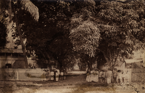 Street scene in Papeete, Tahiti. Courtesy of Church History Library.
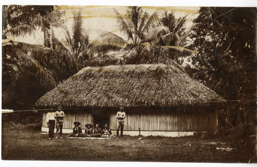 Tahitian house and family. Courtesy of Church History Library.
Tahiti and surrounding islands are in some respects the most important group in the South Pacific Ocean. There is perhaps no spot on the globe which has received a more lively attention than this from the great experiment of the civilization of man by means of religious influence. The islands themselves are not so important to the rest of the world. It is generally believed that the great Spanish expedition under Pedro Fernandez de Queirós discovered Tahiti in 1606; but like many other Spanish discoveries, this was unknown or unnoticed by the rest of the world, so that when the ship Dolphin, under Captain Wallis, sent by George III of England to make discoveries in the South Seas, reached Tahiti June 19, 1767, it was supposed to be the primary discovery, and it was named King George Island. Captain Wallis reached it on the southeast side and was soon surrounded with a multitude of canoes filled with natives, who were friendly but thievish; this latter propensity led to a slight skirmish. Wallis sailed along the coast and on the 23rd discovered Matavai Bay. Lieutenant Furneaux landed and took formal possession in the name of George III by hoisting a British flag. The flag was soon taken down by the natives and was made by them into a badge of sovereignty for many years afterwards.
April 2, 1768, M. de Bougainville, a Frenchman, arrived at Tahiti in the frigate Bondeuse, and remained till the 14th. He called the island Nouvelle Cythere.
In 1768 Captain James Cook was dispatched by the British government to the Pacific Ocean to make observations of the transit of the planet Venus. He sailed in the Endeavor with an efficient staff of scientific observers and arrived at Matavai Bay, Tahiti, April 12, 1769. A small fort was erected near the northernmost point of the island, and the transit observed on June 3 following. The point thus became one of the then best-determined positions in the western hemisphere and was called Point Venus. Cook surveyed the chief island, Tahiti, and discovered several of the northwestern group, to which he gave the appellation of Society Islands.
Having great reason to believe that the English intended to establish themselves in the South Seas, the Spanish government ordered an expedition sent to Tahiti from Lima, South America. It came in the frigate Aquila, in command of Don Domingo Bonecheo, and arrived on November 10, 1772, at Tahiti, which was named Amat, or Tagiti. His report on returning caused an attempt to colonize, for in 1774 Bonecheo was again sent with two Franciscan missionaries and other means of establishing a settlement. Captain Bonechea made a minute examination of the islands but unfortunately died January 26, 1775, and was buried at the foot of a cross they had erected on first landing. In the meantime Captain James Cook, in company with Captain Furneaux, in the Resolution and Endeavor, had again visited Tahiti and heard of the Spaniard’s visit eleven years after Captain Cook’s second visit. Lieutenant Bligh, who had also sailed with Cook as master, arrived in Tahiti in command of the Bounty, which had been commissioned by George III to transport breadfruit trees to the West Indies islands. The Bounty arrived at Matavai October 26, 1788, and her five months’ sojourn allowed her crew to form connections with the native women. This led to the mutiny on the Bounty, by which Captain Bligh and those who remained true to him were put off the ship near the Tonga Islands, while the mutineers returned to Tahiti, and some of them with their Tahiti women subsequently settled Pitcairn Island.
The frigate Pandora, commanded by Captain Edwards, was sent in search of the Bounty and her mutineers and arrived in Tahiti March 23, 1791, and took away those who had remained, fourteen in number, three of whom were afterwards executed at Spithead. Vancouver also visited Tahiti in 1791.
The foregoing voyages ordered by George III excited wonderful attention in England, and one result of them was the formation of the London Missionary Society, whose first operation was the outfit of a vessel, the Duff, which was to carry missionaries and the Bible into these newly discovered islands. The Duff sailed from the Thames, England, August 10, 1796, and, after visiting the group to the eastward, arrived at Tahiti Sunday, March 5, 1797. After laboring for many years, these missionaries succeeded in converting the natives to Orthodox Christianity.
It seems that the very success of the English missionaries led to their downfall. The exclusive system introduced, and the harsh and intolerant measures proposed and effected, carried their own retribution. The success of the French mission in the Gambier Islands and other places induced the Catholics to send two priests, M. H. L. J. Laval and F. Caret, to Tahiti, in order to establish their rule of faith in Tahiti and neighboring islands. This was fiercely opposed by the English missionaries, and the consequence was that the two Catholic priests and a third person, A. Vincent, a carpenter, were forcibly deported from Tahiti September 12, 1836. This aggression against French subjects naturally drew down the vengeance of the government, and the frigate La Venus under Admiral Dupetit Thouars arrived in Tahiti in 1842 and demanded 2,000 piasters as an indemnity for the violence offered to French subjects and obliged Queen Pomare to sign a treaty which allowed liberty to all French subjects.
The following extract from the Colonial Gazette (a paper published in London, England) of March 19, 1845, will show how some of the British people at home viewed the actions of the Protestant missionaries at the time—actions that undoubtedly more than anything else are the cause of Tahiti and surrounding groups of islands being a French instead of a British colony at the present time:
“The three Frenchmen were expelled from Tahiti by force September 12, 1836, after having been kept in confinement twenty-one days. Two of them were Catholic priests and the third a carpenter. September 3, 1837, Count Mole applied to Vice Admiral Rosamel to instruct the French admiral in the Pacific to procure redress for the injury done to three French citizens.
“When the French admiral arrived, Mr. Pritchard fled to England; on his return he found the French protectorate established and advised Pomare to haul down the French flag. This transformed a question which had originally interested only a few scattered Catholic devotees in France, Italy, Germany, and Britain into a question which excited the whole French nation. The excitement is intense. The common people are inflamed by a song from their popular poet, Barthelemy, entitled, ‘Les Prit-charactes.’ There are shows going about the fairs representing the marriage of Pritchard and Pomare. Two steamers have been ordered to Tahiti; 1,000 soldiers have already sailed; and eleven French ships of war of different sizes are in or going to the Pacific. The whole religious Roman Catholic world has been aroused. Two bishops have been sent to Tahiti and the Gambier Islands; and the young priests in the seminaries are one and all anxious for appointments. These are the fruits of the intolerant and outrageous conduct of Mr. Pritchard and the English missionaries to Tahiti.”
The same paper of July 5, 1845, says: “The French minister for the Marine and for the Colonies stated on the 23rd of June, 1845, in the French chamber that the present number of troops at the Marqueses and Tahiti was 2,288, belonging to the army, and 1,005 seamen. * * * The debates in the chamber on the 23rd ult. prove that the difficulties are not yet evaporated which have been created by the missionary Pritchard having turned politician and driven the French citizens from the island.
“Discussion and public meetings may take place—pamphlets and statements by dozens; but the result is an accession of French physical power in the Pacific and the almost universal spread of the Catholic religion. Verily, gentlemen of the Protestant Mission Societies, your political interference has come to something; or to use a vulgar expression, ‘You have burned your fingers’—it is you who have provoked all this.”
The opinions expressed by the Colonial Gazette were proven to be correct by the events which had already transpired and which followed. Early in January 1844, Captain Bruat landed a strong force in Tahiti, hauled down Queen Pomare’s standard and hoisted the French flag, taking possession of the island in the name of Louis Philippe, the king of the French. A seven years’ war between the French and the natives followed, which ultimately ended in victory for the French. After this the island was nominally under the French protectorate until 1880, when King Pomare V finally renounced in favor of France all his rights and authority over the Society Islands and their dependencies, which since then have been French possessions.
The French possessions of Oceania at present consist of the Tahiti, Moorea, the Tuamotu Archipelago, the Gambier group, Tubuai, Raivavae, and Rapa, and the Marquesas; all these had a population of 22,100 in 1892. Besides these the French have extended protectorate over the islands of Rurutu and Rimatara, and also over all the Society group known as the Leeward Islands.
“Jenson’s Travels,” April 16, 1896 [21]
Auckland, New Zealand
From the date of my return to Papeete from the Tuamotu Islands on March 10, 1896, to April 1, 1896, when I sailed on the steamer Richmond for New Zealand, I spent my time on the island of Tahiti, and though I feared beforehand that I would find it tedious waiting, I am pleased to state that I had no occasion to spend a single day in idleness. Busily engaged in arranging and copying my historical notes, perusing and culling from works of authority on the South Pacific islands, writing letters, visiting, etc., the time passed quickly. I also made a few visits to people, with whom I naturally became acquainted; called on government officials for dates and other information; and perused books at the municipal library, trying my hand at deciphering French, for nearly all the books there were printed in the French language. I also applied for the use of a schoolhouse to give one or more lectures in; but Professor E. Ahnne wrote me a polite note of refusal the next day. I was also visited in my room by a few natives, but I could not carry on much of a conversation with them. I bought my provisions and boarded myself but soon found that my knowledge of cooking which I acquired at a railway camp near Ogden, Utah, in 1869 had left me, for I had no success in making my food palatable. Several invitations I received to dine onboard a ship lying in the harbor were therefore doubly welcome under these circumstances.
Among those I visited while staying at Papeete was Mr. J. Lamb Doty, United States consul to Tahiti, who gave me a detailed account of his actions in connection with the attempt of the government to stop our missionaries from preaching in the French possessions in the Pacific. He said that only five forms of religion were permitted by law in Tahiti and its dependencies, namely, Roman Catholics, Protestants, Jews, Buddhists, and Mohammedans; and furthermore, that all the United States consuls and representatives in foreign lands were ordered by the secretary of state at Washington, D.C., in 1884, not to extend any protection whatever to Mormon missionaries. This order was still in force when the trouble arose early in 1895 and the Tuamotu Islands’ governor forbid our elders to preach. Hence when Mr. Doty was appealed to by our people to intercede in their behalf it placed him in a rather awkward position; but he felt it was his duty to protect them, and he did so and was pleased afterwards to learn that his actions were endorsed by the government in Washington. Under date of June 25, 1895, the secretary of state wrote him to the effect that inasmuch as polygamy has ceased to be the “chief tenet in the Mormon faith,” and that their teachings “were now in accordance with good morals and Bible doctrines,” he was to extend to the Mormon elders the same protection as he did to other American citizens. And that is how matters stand at present. Our elders are not legally authorized to preach yet, and cannot be until the French home government places Mormonism on the same footing as the five denominations mentioned above, and then each elder must be provided with separate certificates from the colonial authorities before he is legally authorized to preach in the colony. Mr. Doty expressed the opinion that the opposition to our people was more on the part of the Protestants than the Roman Catholics. The latter are rich and independent and are especially backed by the government. But the French Protestants, who obligated themselves to the London Society missionaries (when they vacated the field many years ago) to pay them a large sum of money for their churches, etc., feel themselves imposed upon by the Mormons. They have “bought” the field from the English fair and square, they say, and think they ought to have it; and here the Mormons have spread themselves over nearly the whole Tuamotu group, preaching the gospel without money and without price, to the great financial loss of the other parties. So, after all, we seem to be the aggressors!
Mr. Doty thought it not advisable for me to see the colonial governor concerning the mission matters, as Elder Frank Cutler in connection with himself were doing all in their power to bring about as speedily as possible the understanding and arrangement which ultimately, it is hoped, will result in perfect liberty for our elders to preach the gospel in the Society Islands and throughout the whole colony.
During my stay in Papeete, I became acquainted with Mr. Isaac S. Henry, a man over seventy years old. He is a son of the Reverend William Henry, one of the first London Society missionaries to Tahiti, who arrived in the Duff in 1796. Mr. Henry holds some peculiar religious views, one of which is that Napoleon III of France is the anti-Christ spoken of by Paul in 2 Thessalonians, chapter 2, and by other inspired writers; he also believes that the English and American people are the ten lost tribes and that the wilderness where the woman, or Church of Christ, as mentioned in Revelation 12:6, will be nourished 1,260 days, is in Utah, God having prepared the place for that purpose. Believing firmly that the United States is the nation which should give the woman “two wings of a great eagle” with which to fly into the wilderness, Mr. Henry felt himself called upon to make a visit to the United States about twenty-five years ago to declare “his special message.” And while engaged in earnest prayer in the town of Calistoga, not far from Oakland, California, on a certain day in 1872, he was impressed to ask the Lord to reveal unto him the exact location of the wilderness where the woman should find shelter. In answer to his request, an audible voice, which seemed to proceed from a place immediately behind him, said, “Salt Lake.” Instinctively, as it seemed, he answered, “Not so, Lord; how can this be, when such enormities are committed by the people there?” and then he turned around to look but could see no one; yet the voice spoke again and said, “They hold the gifts but shall be purified of their enormities.” Since that time Mr. Henry has been a firm believer in the theory that Utah is the place in the wilderness prepared by the Lord for the woman to flee to; and he was much pleased with the historical account I gave him of Utah, and my assurance that no such enormities were ever committed there as he had been led to believe. He visited me a number of times during my stay in Papeete, and I also called at his house; and we had many long and interesting conversations.
Among those I became acquainted with while at Papeete was also Mr. A. C. Andersen, captain of the brig Lorine of Fanø, Denmark. As we were both mutually pleased to meet a countryman in this far-off part of the world, we exchanged visits quite often and conversed a great deal about religion and other matters. I also conversed with the ship’s two mates, Messrs. Jensen and Moller, the latter a native of Svendborg, Funen, Denmark, being of a religious turn of mind and possessing a number of somewhat original ideas about the Bible and Christianity. The Lorine is a new and fine-looking ship of 381 tons register and has principally been chartered for the copra trade since it left Hamburg, Germany, nearly two years ago. From here it is homeward bound. Captain Andersen is a man of broad views, is a “self-made man,” and the principal owner of the ship, which cost 103,000 kroner (about $26,000) when it was built at Fanø, in 1891.
Monday, March 23. I made a visit to Point Venus, an interesting spot about seven miles northeast of Papeete, where Mr. Cadansteau, a French half-caste who has charge of the lighthouse, took me up in the tower, from the top of which the view is very good and quite interesting.
Point Venus, the northern point of Tahiti, is the most important geographical site in the Pacific Ocean, as it has been the point most accurately determined, or at least has had more extensive series of observations made on it than elsewhere. Cook’s first expedition led to this spot to observe the transit of Venus in 1769, and since then a number of other scientific men have made observations here. Point Venus is in latitude 17º29´30 S; longitude 149º28´21”W. There is a small church and a fort at this point, and near it lies the village of Matavai, inhabited by natives and several white men. Near the extremity of Point Venus was the old lighthouse built in 1856, which was in charge of an old French veteran, and near it is still shown the la marine tree planted by Captain Cook close to the spot where he completed his important labors. But on January 1, 1868, the present lighthouse was first illuminated. It was built the year before (1867) which was ninety-eight years after Captain Cook made his important astronomical observations on the point. The lighthouse consists of a square white tower built of coral rock, 72 feet high; and from it is shown a fixed bright light elevated 82 feet above the sea and visible 15 miles off. The ground upon which the tower is built is only ten feet above the level of the sea. Matavai Bay, the best harbor on the island of Tahiti, lies to the westward of Point Venus and was called Port Royal Harbor by its discoverer Wallis in 1767; but this has been superseded by its native name. The road from Papeete to Point Venus is good all the way and is much shaded by the overhanging coconut trees and other tropical vegetation. In going out I watched a gang of natives bringing in their canoe and fishing net from the sea, and in conversing with them I learned a few more Tahitian words in addition to the very limited supply I already had at my command. In returning I called at a native house to get a drink of water, but was given coconut milk to drink instead, which I thoroughly enjoyed.
Wednesday, March 25. I made a trip up in the mountains all alone, some native friends who were to have accompanied me as guides not putting in their appearance at the appointed hour. I started at 7:00 a.m. in the morning. After walking about four miles, which brought me high up in a romantic canyon with very steep mountainsides, it commenced to rain in regular tropical style, and soon my umbrella proved altogether inadequate as a means of protection. Presently I reached an unoccupied native hut near the forks of the canyon, where I left all the clothing which I considered surplus for the occasion and started off even barefooted; but I had only gone a few yards when I was admonished to return for my shoes. It was fortunate I did so, for I found the distance to go much farther and the path much rougher than I had expected, and my bare feet, not having a natural tough sole under them like the natives’ feet, could not have held out against the rocks. Continuing my walk, I soon had to ford the river, a stream of considerable size; and a short distance above the ford I came to the forks of the canyon, where the river and the road also forked. I took the left-hand road, but had proceeded only a short distance when I was prompted to go back and take the other one. In doing so, I had to cross the one fork of the river where the bottom was very rough and rocky. By this time my scanty clothing did not have a dry thread in it; and the rain still descended in torrents; but I was determined to go as far as old Fort Faa Rahi, where the natives of Tahiti withstood the French forces for several years during the long war in the 1840s and 1850s and which consequently is a point of historical importance. After crossing the fork I found myself climbing the side of the mountain very fast by following the winding path, which in many places was overgrown with the tropical foliage and running vines that abound here on nearly all the mountain slopes. At last, after having walked about one and a half miles from the fork or six miles from Papeete, I reached the outer wall of the fort already named. It stands on the top of a precipice nearly 500 feet high, over the face of which leaps the river, thus making one of the most beautiful waterfalls I have ever seen. Being unable to reach the bottom of the falls, I descended from the fort wall to the top of the cataract, where I, among other things, enjoyed a natural shower bath by getting under a little side fall which fell into the river immediately above the big one. After gazing upon the wonders of nature, and the old fortifications, to my heart’s content, and after picking ferns to send home, I retraced my steps down the mountain; but having been exposed to the pitiless storm so long, I at length began to feel cold, though the day was warm. Putting on my shoes, which however immediately filled with water, I was enabled to walk faster, and soon reached the forks of the canyon; but then I found that the rain had swollen the stream to such an extent that instead of the water being only knee deep when I crossed it before, it was now a raging river, which came near washing me away as I crossed it; and had I not clung firmly to a friendly rock which arose from the bottom of the stream to rest myself, I might not have reached the other bank at the point I did. My next effort was to cross the main river, but in venturing out at first I was unable to stand in the current, and in order to escape being washed over the rapids below I quickly retraced my steps, but soon tried again, and at length succeeded by the aid of a pole on the limb of a tree to cross, though not without danger. When I reached the hut where I had left part of my clothing, I discovered that the ants had seized my lunch, and thousands of the little insects were busily engaged in devouring it. Being hungry myself I endeavored to capture from them what they had left; but in doing so, I soon felt myself covered and bitten again and again by the little pests, and I had to jump in the river to get rid of them. While doing so I placed the lunch on the top of an adjacent rock, and when I came back I found that a colt which was grazing nearby had eaten all my cake, so I had to return to Papeete hungry after all, which I did about 2:00 p.m.
Wednesday, April 1. I boarded the steamer Richmond and sailed from Papeete, Tahiti, bound for Auckland, New Zealand, where I arrived on the 13th, having only called at one island (Rarotonga) on the way. The weather being good, we had a pleasant voyage. I gave one lecture onboard which was listened to by nearly all my fellow passengers and the ship’s crew with rapt attention. Among the passengers was the Honorable M. Papinana, governor of the Society Islands and adjacent groups. He is returning to France (not having given satisfaction to his government at home), accompanied by other French colonial officials.
My next field of labor is Australia, and I expect to sail for Sydney on the 20th inst.
Notes
[1] “Jenson’s Travels,” Deseret Weekly News, June 13, 1896.
[2] “Jenson’s Travels,” Deseret Weekly News, June 6, 1896.
[3] The first LDS missionaries didn’t arrive in Rarotonga until 1899 but, having no success, left by 1902. Missionaries returned for good in 1946.
[4] The Deseret News appears to have formatted this paragraph and a few of the following paragraphs incorrectly. We have attempted to correct this to the best of our ability.
[5] Having not heard from his wife for three years, Elder Benjamin F. Grouard thought she had left him. He decided to marry a local girl, Tearo, who bore him a daughter, Sophronia; then Tearo died. Elder Grouard married Nahina, who bore him three sons. In 1852, the family moved to the United States and settled in the San Bernardino colony. After a year, Nahina and two sons returned to Tahiti. The middle son, Frank, stayed in America and was adopted by Addison and Louisa Pratt. Frank later became a famous Indian scout for the US Army. The youngest son, Charles, later returned to America and became a businessman with his father in Santa Ana, California. The oldest son, Benjamin, apparently was at Raiatea when Andrew Jenson passed through.
[6] “Jenson’s Travels,” Deseret Weekly News, June 13, 1896.
[7] This information may form the basis for the serial history Jenson published in the Utah Genealogical and Historical Magazine in twelve parts between January 1914 and April 1917.
[8] This figure for all of French Polynesia is questionable. According to Jenson’s later description, a figure of 28,000 is more appropriate.
[9] The Three Voyages of Captain James Cook Round the World (London: Longman, Hurst, Rees, Orme, and Brown, 1821), 4:133–34.
[10] “Jenson’s Travels,” Deseret Weekly News, June 20, 1896.
[11] “Jenson’s Travels,” Deseret Weekly News, June 27, 1896.
[12] Doctrine and Covenants 124.
[13] “Jenson’s Travels,” Deseret Weekly News, July 11, 1896.
[14] Frederick J. Moss, Through Atolls and Islands in the Great South Sea (London: Sampson, Low, Marston, Searle, & Rivington, 1889), 27.
[15] Moss, Through Atolls and Islands, 29.
[16] Moss, Through Atolls and Islands, 31.
[17] Moss, Through Atolls and Islands, 41–42.
[18] This paragraph is a partial quotation from Moss, Through Atolls and Islands, 35–36, with the addition of a few other details.
[19] “Jenson’s Travels,” Deseret Weekly News, July 18, 1896.
[20] “Jenson’s Travels,” Deseret Weekly News, August 1, 1896.
[21] “Jenson’s Travels,” Deseret Weekly News, August 8, 1896.
